Weather Blog: Little Bit Of This, Little Bit Of That
A relatively stagnant upper-level low which has kept western Wisconsin under the clouds for much of the weekend will again allow clouds to persist into the overnight period with isolated showers to impact the area. A passing shower is also possible tonight as far east as the Twin Cities and western sections of the metro.
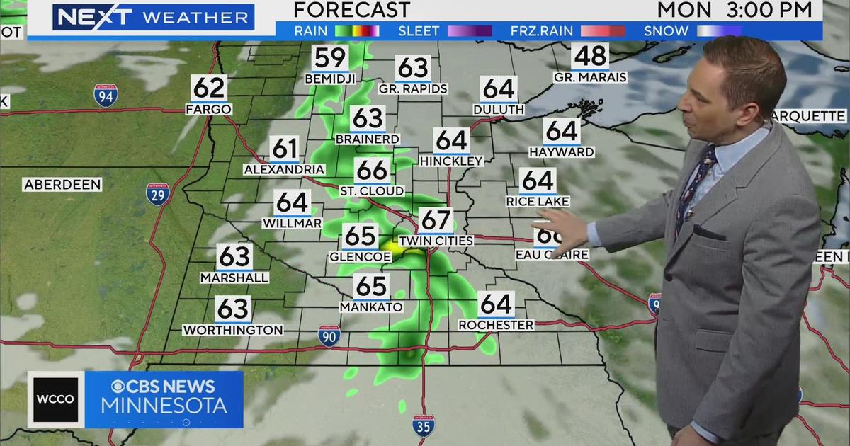
On Monday, the upper low will aid in creating a division between mostly sunny and pleasant weather across western Minnesota, where the system's impact will be minimal, to mostly cloudy conditions with scattered showers in the forecast for western Wisconsin. In the Twin Cities, we'll be hanging out in the middle with a mix of clouds and sun with a few showers possible especially later in the day.
Expect highs in the upper 60s in the metro with slightly warmer temperatures west where the sunnier conditions will prevail.
The upper air system will finally exit the region late day Tuesday, allowing sunshine to return to cloud-plagued Wisconsin with above-average highs in the middle 70s in the forecast by Wednesday.