Weather Blog: Sunny Start But Showers Will Return
It was a showery Sunday as many areas across the state picked up at least a trace of rainfall. Most rainfall totals failed to exceed 0.10" but a few locals experienced heavier shower activity, contributing to totals between .25"-.50" with 0.39" in Aitkin over the last 24 hours, 0.33" in Duluth, 0.27" in Wadena and .24" in Brainerd.
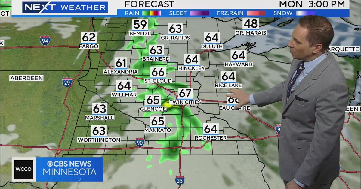
The showers will continue to move off to the east with continued clearing into this evening and the overnight. Expect a sunny start to the work week, but the rays will be brief as the clouds will increase through our Monday in advance of an approaching area of low pressure. This system will bring another chance for showers beginning Monday night and continuing into Tuesday. The best chance for rain will be from the Twin Cities east.
Cooler air begins to dip into northern Minnesota on Monday, which will create a temperature gradient across the state with highs in the 40s across the north to 60s across the south for both tomorrow and Tuesday. This gradient will diminish by Wednesday with a cool day for all, with highs in the 40s for much for the state.