Spring Warmup May Soon Turn To Snow
MINNEAPOLIS (WCCO) -- Minnesota weather never disappoints!
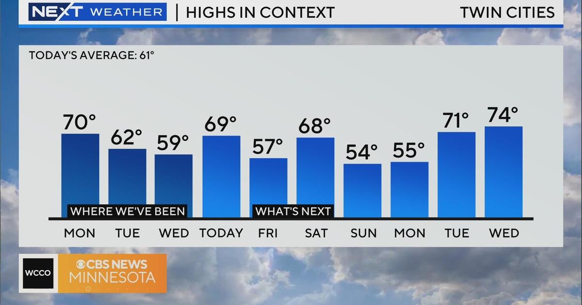
After a Saturday in the mid-70s, we may swing back to snow by Monday.
Meteorologist Mike Augustyniak says it will cool down to the mid-50s overnight, and we'll wake up to a chance of showers Sunday before warming into the mid-60s.
Thunderstorms and heavy rain will start to develop by the early evening. Far northern Minnesota will likely stay mostly dry Sunday, but the rest of the state will have an increasing chance for rain and storms through the afternoon and into the overnight.
There is a slight risk for stronger storms Sunday south of the Twin Cities, with a tornado possible in the southeastern and south central part of the state.
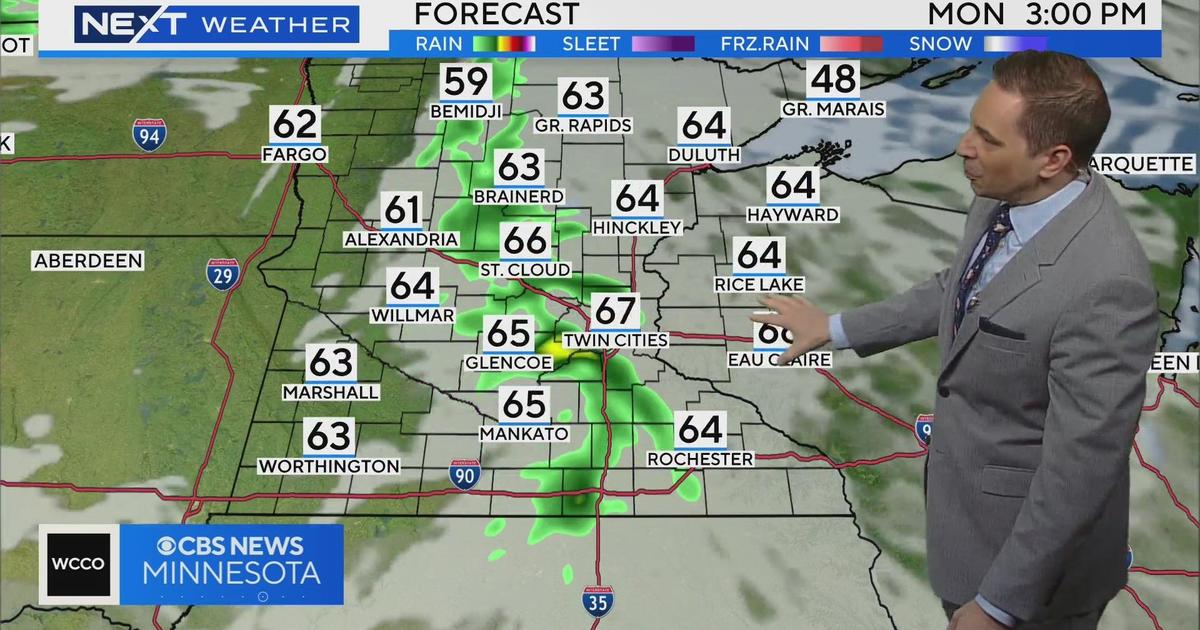
This storm system will have a little pocket of cold air aloft on Monday, so there is a good chance we could see the rain turn into wet snow, especially north and west of the Twin Cities metro, but we may even see some of it in Minneapolis and St. Paul.
Download the WCCO Weather App to stay on top of the latest storms, watches and warnings.