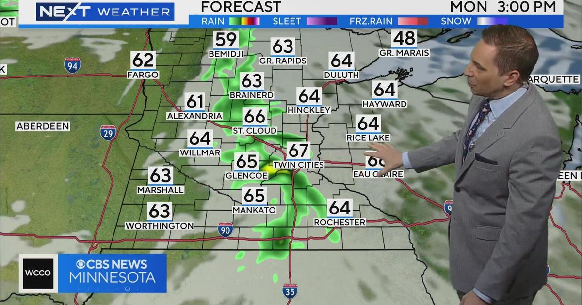
Severe Storms Track Across Minn. With More Expected Tonight
MINNEAPOLIS (WCCO) -- Strong storms producing small hail and 50-60 mph wind gusts are flaring up across western Minnesota Tuesday morning – with more severe storms expected in the late evening.
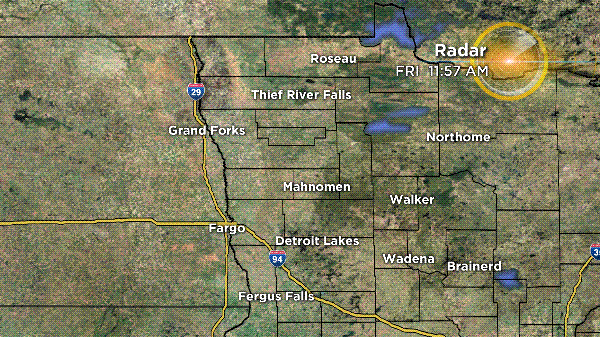
As of 7 a.m., the storm was making its way through Fergus Falls, Morris and Alexandria.
According to meteorologist Matt Brickman, the storms will continue to track northeast through Minnesota as the day goes on, through the Brainerd Lakes and up towards the north shore. Those storms should be out of Minnesota by mid-afternoon.
http://radar.cbslocal.com/anim/wcco/radar13_anim.gif
In addition to temps in the high-80s, dew points will be also be reaching oppressive levels -- around 70° by mid-day.
"One, that makes it really uncomfortable for us," Brickman said. "But it's also going to provide fuel for these storms to develop later on today. It could be explosive by the time they do develop later on tonight."
The second round of severe storms is expected to flare up around between 8 to 10 p.m. in western Minnesota with an enhanced risk of severe weather that includes large hail, wind damage and possible tornadoes.
The Twin Cities should see severe storms in the late evening, in the 10 p.m. to 2 a.m. range.
On Wednesday, early morning storms are expected in western Wisconsin and possibly eastern Minnesota.


