Spring Flooding Potential Near Normal
MINNEAPOLIS (WCCO) -- Our week of warmth has a lot of people thinking spring, and meteorologists thinking about the potential for flooding.
Thursday, on the first day of Meteorological Spring, forecasters gave us an early look at the flood potential for March, April and May.
There are four factors that affect the potential for spring flooding -- and this year, three of the four are near normal.
The first factor is how much moisture is in the soil. Precipitation in February was near or slightly above average, but November, December and January were dry. The bottom line: we're close to normal on soil moisture.
The second factor: how much moisture is frozen in our snowpack. This year it's near normal.
Next: how deep does the frost go? This can affect runoff as springtime melting begins. Frost depths this year are around 2 to 3 feet; again, normal.
The one factor that's above normal is the chance for spring rains -- the main driver of flooding. The March-April-May outlook shows an increased chance of precipitation over our area.
All of these factors combined lead a spring flooding threat that is near to a little above normal for minor flooding in general.
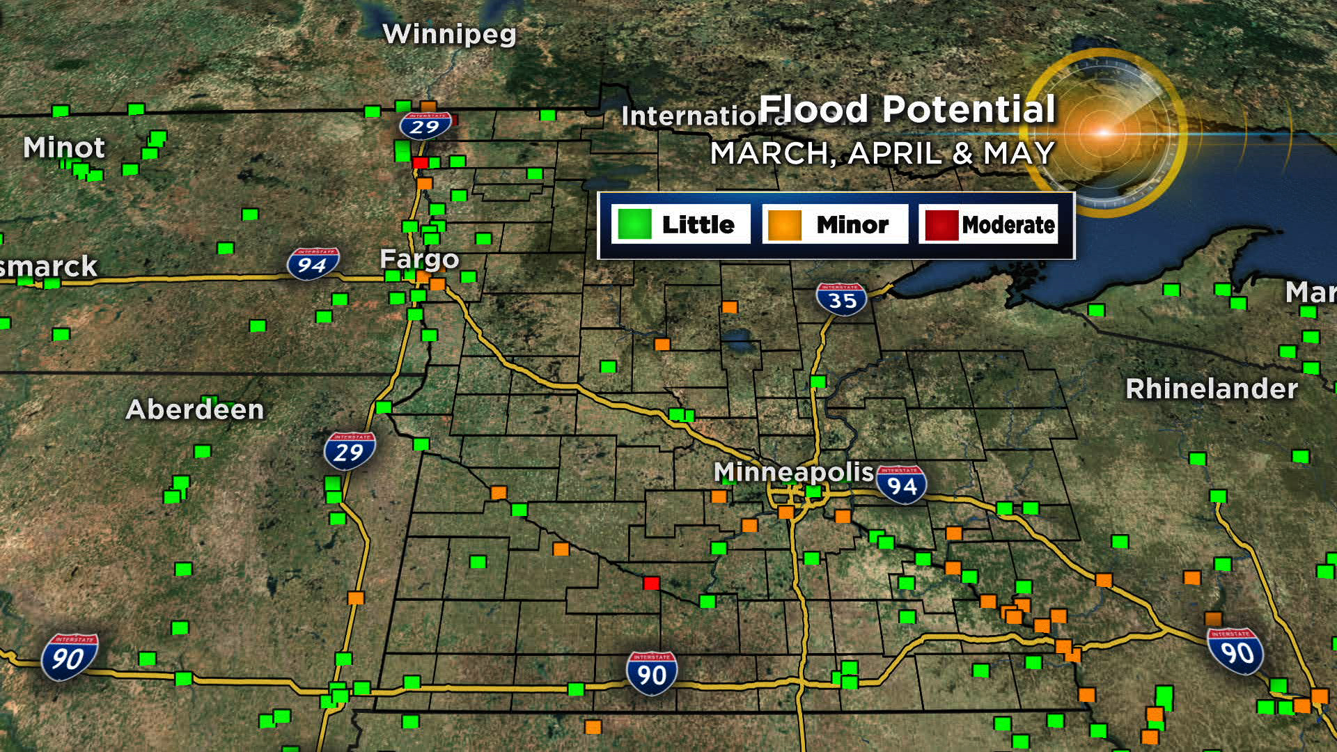
There are a few specific areas of higher concern though -- including the Red River, which has a higher-than-normal chance of moderate flooding through May, north of Grand Forks. The same goes for the Cottonwood River near New Ulm.
On the map below, orange dots mean a higher-than-normal chance of minor flooding.
And here's a concern for the short term -- With snow still on the ground, and an inbound storm that promises to bring 48 hours of precipitation, the combination of melting, runoff, and clogged storm drains will create some street flooding starting this weekend.