Weather Blog: Pretty Dreary
MINNEAPOLIS (WCCO) -- On average, November and December are our cloudiest months. We are living up to it these days.
There are many factors contributing to our clouds.
First, our snow is melting with temps hovering just above the freezing mark. Second, there is an inversion in play with warmer air above the cooler air near the ground. Third, the inversion is trapping the moist air from the melting snow near the ground causing fog at night (simply a ground cloud).
A southwest wind comes to the rescue ushering in drier air and pushing the clouds away. Warm air will also come our way with highs back in the 40s Wednesday and surging into the 50s for Thanksgiving.
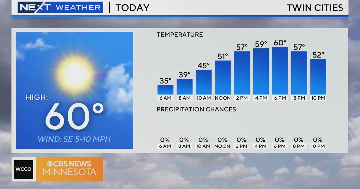
There is an outside shot we could hit 60 degrees in the Twin Cities. If that happens, it will be a new record high for November 24th.