Warm Temps On Their Way, But Possible Storms, Too
MINNEAPOLIS (WCCO) -- Good news -- this week is shaping up to have some nice, toasty temperatures. The bad news? That means storms are likely, as well.
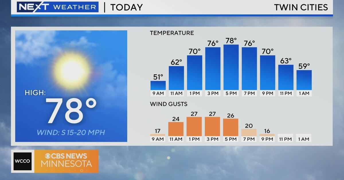
A nice breeze will kick in Monday to help push some of those dreary clouds out of the way and make room for increasing sunshine. Temperatures will hit the 70s and stay dry but Tuesday's another story.
Temperatures will be a balmy near-80 but with it comes the chance for thunderstorms and severe weather. The day will start off pretty quiet and sunny but rain and thunderstorms will develop after 1 p.m. in western Minnesota before moving east.
Rain and thunderstorms will hit the Twin Cities in the late afternoon to early evening and bring threats of damaging winds, hail and even tornadoes.
The best chance for tornadoes, if they do form, will be mainly from Interstate 35 and west. The biggest threat will form around 9 p.m. and later.
Once the worst of the thunderstorm threats have moved on, we'll still see off and on rain through the weekend and scattered storms. The timing of upcoming severe weather and thunderstorms is tough to tell, but we'll keep an eye on them as the week progresses.
The good news through the soggy and wet conditions is that those temps stay in high 70s through the week.