Minn. Sees More Than A Foot Of Snow In Season's 1st Storm
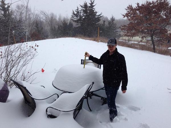
MINNEAPOLIS (WCCO) – The flakes of the season's first major snow storm began falling on Minnesota Monday morning, and by the time the clouds clear out Tuesday, around a foot of snow could blanket a swath of the state.
The National Weather Service has issued a winter storm warning for a chunk of counties in central Minnesota and northern Wisconsin. The storm is making its way across the Midwest, slithering west to east, and the Twin Cities metro looks to be right in its path. Already, school districts north of the metro have canceled classes for the day, as over a foot of snow could fall in those areas.
Winter Resources: School Closings | Live Radar | Send Us Photos | Traffic Cameras
Meteorologist Matt Brickman said the snow began falling at around 3 a.m. Monday, and will continue throughout the day. Temperatures will warm to just around freezing at noon, and that's when heavy, wet snow will likely fall on the state. This snow could cause power outages and be difficult to shovel. It also looks to make a mess of the evening commute.
Around 1 p.m., reports came in from St. Cloud saying there was 10 inches of snow on the city's university campus. WCCO Weather Watchers also reported 15 inches of snow in Starbuck, in west-central Minnesota, and nearly 6 inches of snow in Pine City, which sits just northeast of the metro.
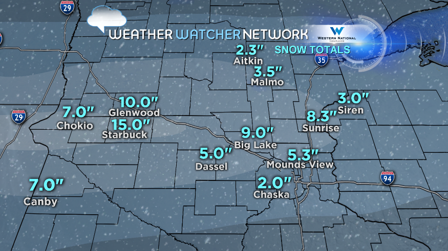
The heaviest snow looks to fall on a line of cities stretching from Madison, Minnesota, through St. Cloud, the northern Twin Cities metro, and into Ladysmith, Wisconsin. In these places, snow totals could range from 12 to 18 inches, with higher amounts possible. Brickman says the highest amounts could fall in a pocket of cities northeast of the metro, including Hinckley and Hayward, Wisconsin.
On the storm's southern edge, there will be a sharp cutoff in snowfall. The weather service says from the southern metro to Eau Claire, Wisconsin, cities could see 6 inches. Brickman says they could see as few as 4 inches.
Winds will also be a factor. Northeast winds gusting at 15 to 25 mph will cause drifting and blowing snow, making travel hazardous. MnDOT says its plows will be on the roads and equipped with enough salt to fight the elements. Whether or not Minnesota drivers are ready is another question.
"Folks need to slow down, they need to add time to their travel," said Kevin Gutknecht, a MnDOT spokesperson.
As of noon, the State Patrol reported 180 crashes on Minnesota roads, and nearly as many spin-outs. Some 15 of those crashes resulted in injuries, but none were serious. No fatalities have yet been reported.
The winter storm warning will remain in effect until noon on Tuesday. Keep ahead of the weather by watching WCCO-TV and checking back with WCCO.com.