Weather Blog: Why Has Minnesota Been Spared From Snow?
MINNEAPOLIS (WCCO) - Minne-snow-ta? Not this season!
So far, the Twin Cities has received 25 inches of snow, with a measly 1 inch of snow depth currently on the ground.

Whereas in Boston, an abominable 100 inches of snow has fallen this season, with more than 58 inches (4.8 feet) of that accumulating in February's first 15 days! At Blue Hill observatory, just south of Boston, 3 feet of snow remains on the ground.
Known for bright lights and never sleeping, and not so much for snow-y scenes, the seasonal snow total for New York City is greater than for the Twin Cities, at over 28 inches, with over a foot currently on the ground in Central Park.
So why is Minnesota being left high & dry while the Northeast continues to get snow-pocalypsed?

To produce a solid snowfall, two main ingredients are needed: moisture and cold air.
For East Coast cities like Boston and New York, moisture isn't difficult to find, thanks to easily accessible Gulf moisture and, of course, the near-by Atlantic Ocean. Moisture influx is exacerbated when a storm system passes just off-shore and its counter-clockwise circulation pulls in moisture-rich Atlantic air.
The extreme and persistent cold has played a major factor in this season's East Coast snow barrage. The average temperature for Boston so far this month is more than 12 degrees below average! The average high temperature for Bean Town is currently 40 degrees.
Similarly, in NYC the average February temperature is running over 10 degrees below average and the average high temperature is currently 43 degrees.
Thus one could essentially deduce that if these cities were experiencing average to above-average temperatures, the moisture influx would have materialized as rain -- not snow.
So why has it been so cold out East? And why has the storm track kept a quasi-permanent position over the Northeast? The answer begins with our old friend El Niño.
At its core, El Niño pertains to above-average warming of the waters of the equatorial Pacific and, as you might expect, this has atmospheric implications.
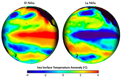
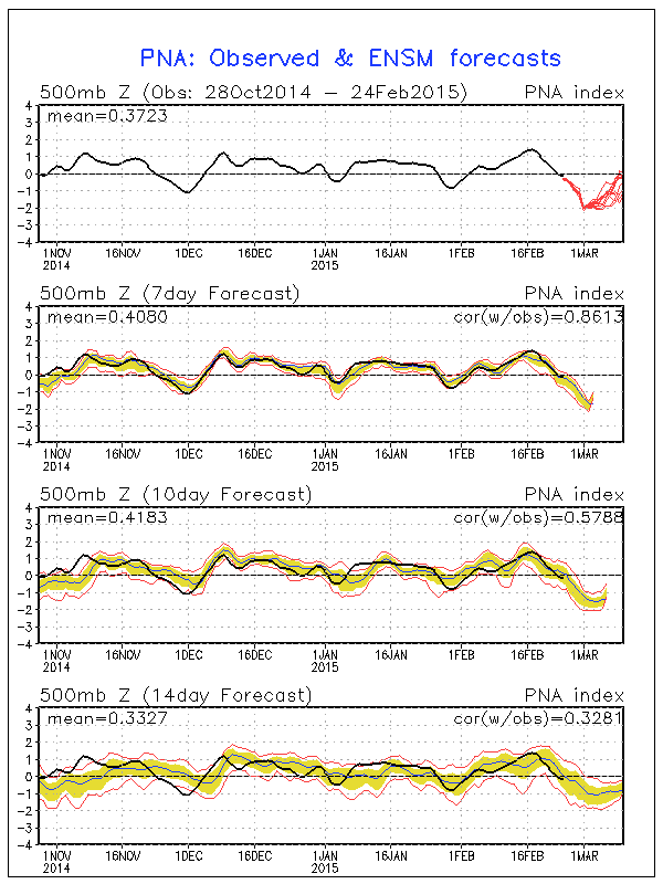
The Pacific/North Atlantic Oscillation, or PNA, is one of the most influential climate patterns in the Northern Hemisphere and is strongly influenced by the El Niño and La Niña phenomena. PNA describes upper-level atmospheric wind patterns which are categorized into phases: positive or negative.
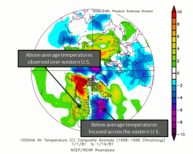
A positive phase of the PNA pattern is characterized by the ridging of upper-level winds over the western U.S. and conversely deep troughing over the East. To think of it in general terms, ridging equates to warmth and troughing to cold. This troughing opens the door to arctic air over Canada, allowing it to spill across the East Coast.
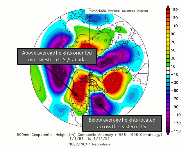
Upper-level winds, namely the jet stream, also act as driver of storm systems. In a +PNA pattern, the jet stream tends to flow in a particular orientation that steers storm systems up and along the Atlantic Coastline.
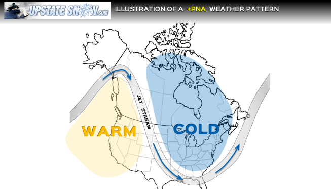
Since (so far this season) storm systems continue to ride along this more southerly track, Minnesota misses out on the snow action.
The PNA index has been positive for much of January and February, however, and models are indicating a phase shift as March approaches. And as March is the metro area's third snowiest month climatologically, some fluffy white may still be in sight for us.