Weather Blog: Sweaty Santa?
When news that a weather buoy near the geographic North Pole hit the freezing point on the first full day of 2016-17 winter -- almost 50° above average -- I thought "Hmmm, didn't this happen last year?" Indeed, it did; almost exactly a year ago.
As the Washington Post's Capital Weather Gang blog reported, on December 30, 2015, another weather buoy near the North Pole registered a temperature of 33°F.
So, what's going on? How did this insane amount of warming happen once, let alone in back-to-back years? For that, we have to look at Arctic sea ice -- a major player in climate and weather patterns at the North Pole.
ICE, ICE BABY.
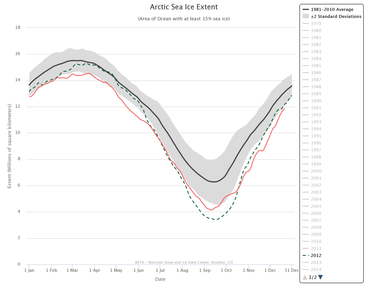
As this chart from the National Snow & Ice Data Center shows, the amount of sea ice in the Arctic tends to reach a low in mid September, due to seasonal warming. The extent of Arctic sea ice increases through the winter, reaching a peak in mid March, on average.
In recent years, however, the extent of arctic sea ice has dropped drastically, even during the winter. In fact, the 10 years with the least arctic sea ice since observations began have all occurred since 2005. The least amount of sea ice for any November on record was reported in 2016.
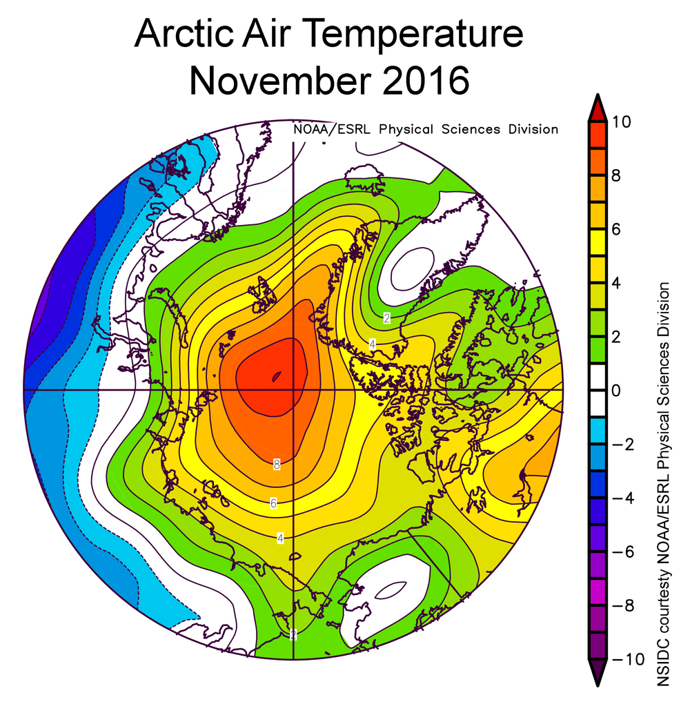
Like any frosty beverage, when there's less ice in the ocean the water remains warmer; in turn, the air above the surface of the water tends to be warmer. The chart to the left shows air temperatures compared to average for November 2016; the red bulls eye over the North Pole tells us that temperatures were 27° above average for the month.
COULD THE LACK OF ARCTIC SEA ICE BE THE CULPRIT? THE INDEPENDENT CLIMATE WEBSITE CLIMATE CENTRAL SAYS YOU BET.
"There's also been a ton of missing sea ice in the region — the result of what's been a really abnormally warm year for the region all around. That's left warmer ocean waters exposed, essentially helping lock in warmer-than-normal air temperatures..."
Combine that setup with a strong storm east of Greenland, which is funneling large quantities of heat into the high Arctic on screaming southerly winds, and you get this warmth that's eye-popping.
Not just for scientists, but also for Santa.