Interactive Map Helps You Find Roads Aligned With Setting Sun
MINNEAPOLIS (WCCO) -- You may have heard of the Manhattenhenge, where the solstice sunset aligns with certain streets for once or twice a year, but did you know there are spots in the Twin Cities where you can also view this phenomenon?
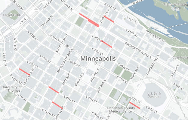
Now, there's an interactive map that helps you find those roads.
For example, in downtown Minneapolis, parts of 10th, 9th, 3rd and 2nd streets have these viewing points – as well as Washington Avenue.
The map is not limited to the Twin Cities, too. It extends out over 30 miles in every direction.
The sunset in Minneapolis on Wednesday is expected at 9:03 p.m.![]()