Highs In The 70s Expected Wednesday, Severe Storms Possible
MINNEAPOLIS (WCCO) – Get ready for a one-day summer flashback before we fall back into fall.
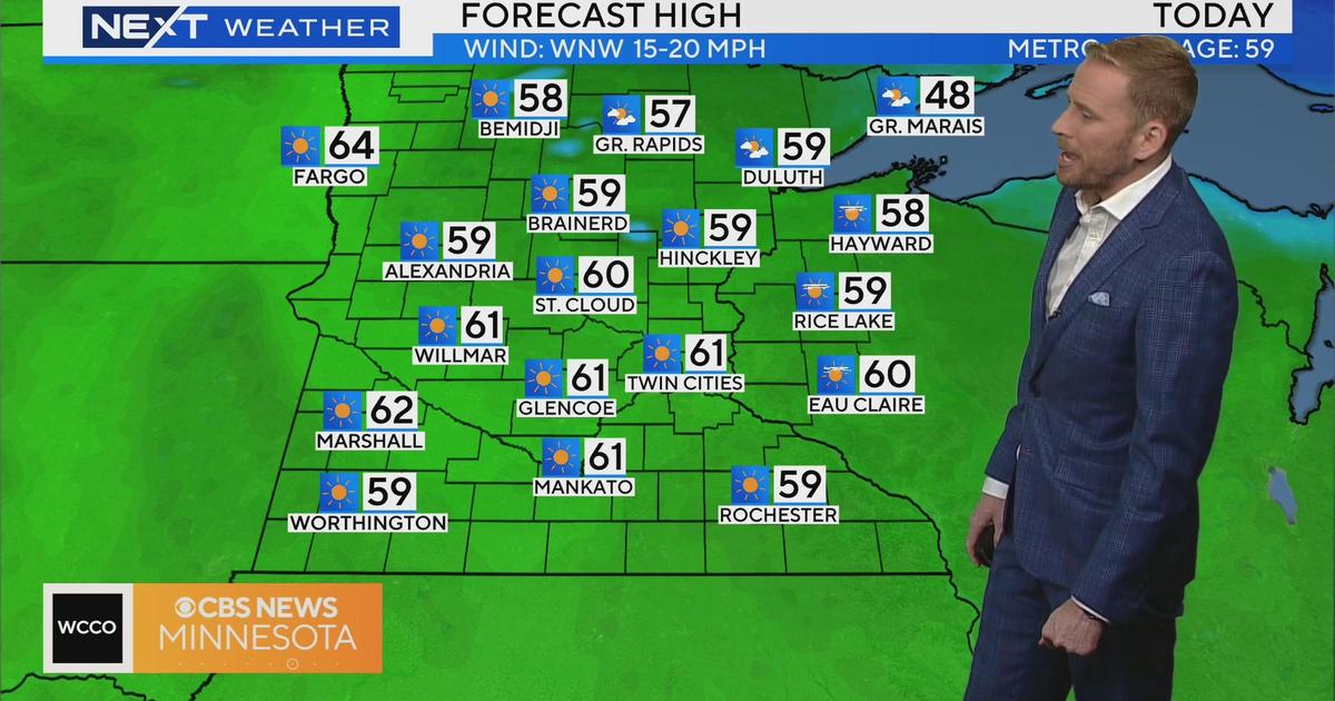
The forecast for Wednesday doesn't look at all like typical fall weather for Minnesota, as highs are expected to climb into the upper 70s and stir up severe storms, and possibly tornadoes.
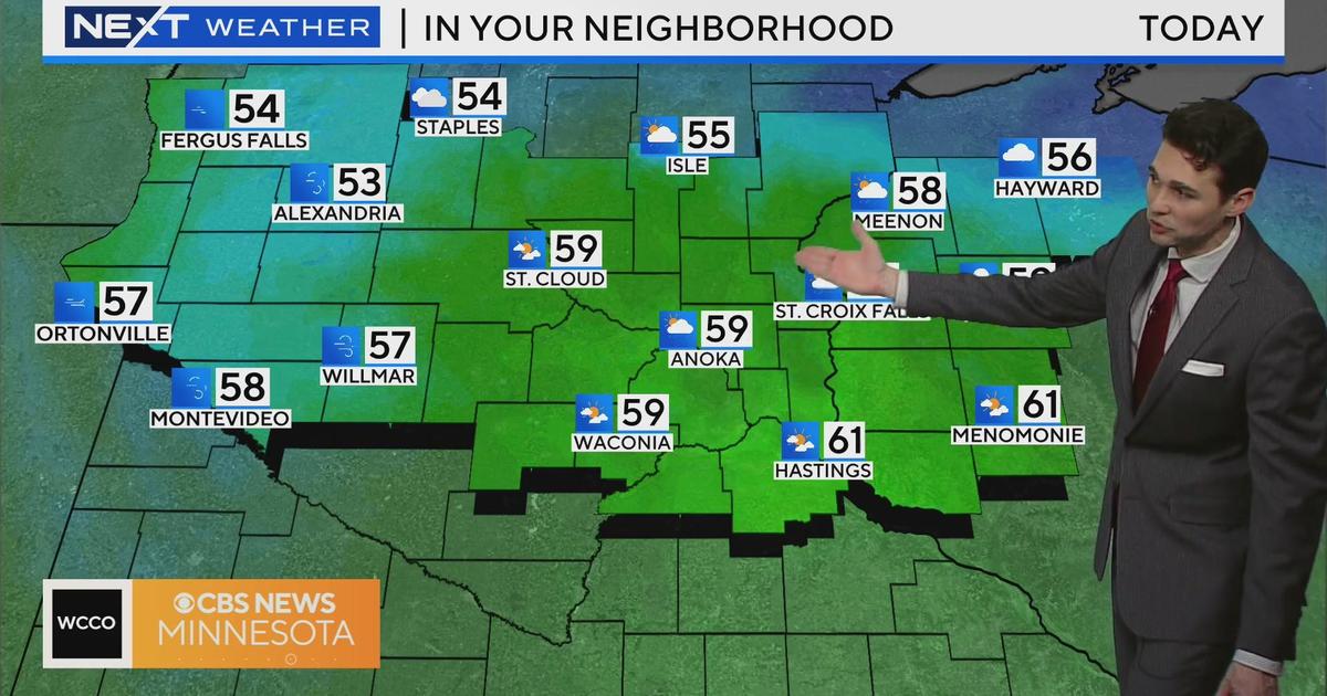
Meteorologist Chris Shaffer says we've been hanging around in the low 50s for the past few days, but winds from the south will pump moist and milder air through the state in the overnight. By 8 a.m. Wednesday, it will be in the mid-60s, with winds from the southeast at 8 to 12 miles per hour.
But southwestern winds as fast as 20 miles per hour will pick up by midday, push temps into the mid-to-high 70s in the metro by the late afternoon.
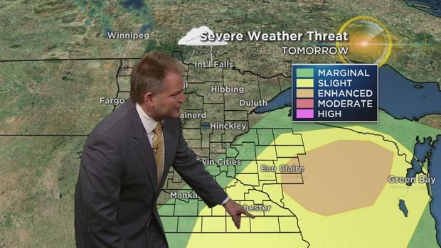
Winds from the northwest will move in by late Wednesday night, bringing the slight risk of severe weather to southwestern Minnesota. The main threats for most of the state are damaging winds. Wisconsin will get the brunt of the severe storms and rain.
Scattered showers are actually possible throughout the day throughout Minnesota.
As the storm system moves out of the state, temperatures are projected to plummet. Some communities could see a 40-degree drop between Wednesday night and Thursday morning.
Looking ahead, the rest of the workweek and weekend are expected to be cool, with highs in the mid-50s. Average highs for this time of year are in the low 60s.
Oh, and some folks up north may even get some snow on Friday!