After A Chilly Start To 2019, Temperatures Could Climb Above 40 This Weekend
MINNEAPOLIS (WCCO) – On the second morning of 2019, Minnesotans again woke up to frigid temperatures and sub-zero wind chills. But, the arctic cold isn't going to stick around long.
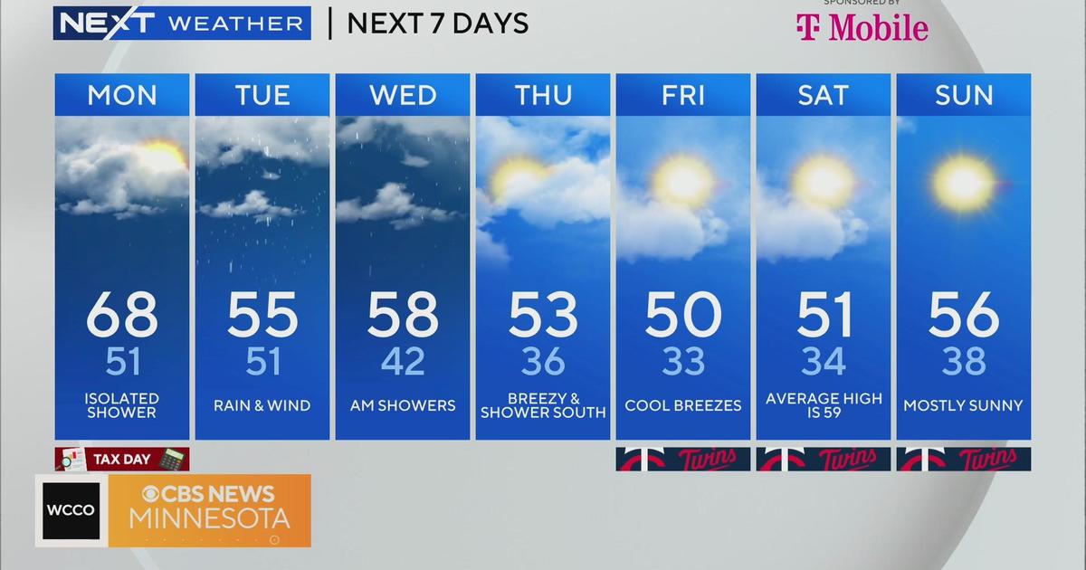
Unusually mild weather is expected for the next several days, with the warm-up starting Wednesday and continuing through the weekend.
On Thursday, highs are expected to reach the upper 30s in the Twin Cities. By Friday and Saturday, temperatures look to climb into the 40s, challenging record highs.
Such warmth is well above average for January. Highs is the upper 30s/lower 40s are usually typical for mid-March.
A big warm up coming by the end of the week could bring record high temperatures to Minnesota. #mnwx pic.twitter.com/RGfvPdAbmT
— Matt Brickman (@Matt_Brickman) January 2, 2019
Still, before the warm-up, Minnesotans must make it through the cold.
Temperatures Wednesday morning dipped into the single digits, and wind chills in northern Minnesota were as frigid as 30 below zero.
There is a wind chill advisory for much of the Iron Range and the Arrowhead, covering communities such as Brainerd, Duluth and Ely.
When wind chills are 25 to 35 below, frostbite can set in on exposed skin in 30 minutes.
The advisory is slated to last until 9 a.m.
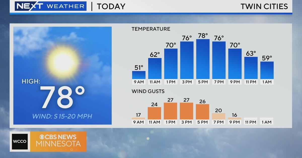
Temperatures Wednesday are expected to climb to near 20 degrees in the Twin Cities.
Also, there's a chance for flurries or a dusting of snow, with a weak system making its way over central Minnesota, passing through the metro area in the afternoon.
The next chance for snow looks to be early next week. Some areas could also see rain.
Before that, however, there'll be some significant melting over the warm weekend. Expect much of the ice on Twin Cities sidewalks and streets to melt in the coming days.
Today will start out cold, but we'll warm up to near 20 by the afternoon. Looking ahead, a prolonged mild weather pattern will keep temperatures in the 30s to neary 40, which is well above normal for early January #mnwx #wiwx pic.twitter.com/ZkiLOXN7xP
— NWS Twin Cities (@NWSTwinCities) January 2, 2019