Minnesota Weather: Severe Storms Move Across State Monday Night
MINNEAPOLIS (WCCO) – Labor Day, the unofficial end of summer, is bringing a threat of severe storms to the Twin Cities.
Update as of 11 p.m.:
A tornado warning has been issued for Le Sueur and Rice counties until 11:15 p.m.
A severe thunderstorm watch has been expanded to include the entire metro area. Straight-line wind damage is the main threat with these storms, but hail and isolated tornadoes are also possible, Meteorologist Lisa meadows says. Residents are advised to stay weather aware into the overnight.
Severe storms are currently making their way into northwest Minnesota Monday. A severe thunderstorm warning has been issued for Anoka, Carver, Hennepin, Isanti, McLeod, Ramsey, Scott, Sherburne and Wright counties until 10:45 p.m.
As for Tuesday morning, when many children will be at the bus stop for their first day of classes, there could be lingering showers.
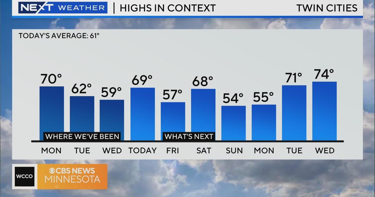
However, after the storms move out, Tuesday looks to be partly cloudy with highs in the mid-70s.
The mild weather looks to stick around through the end of the week.
---
WATCH: Meteorologist Lisa Meadows has the latest on severe storm threats in Minnesota.