Minnesota Weather: Big Weekend Storm To Grace Some With Snow, Others With Rain
MINNEAPOLIS (WCCO) -- A messy storm is seeking to mess up our weekend, according to WCCO Chief Meteorologist Chris Shaffer.
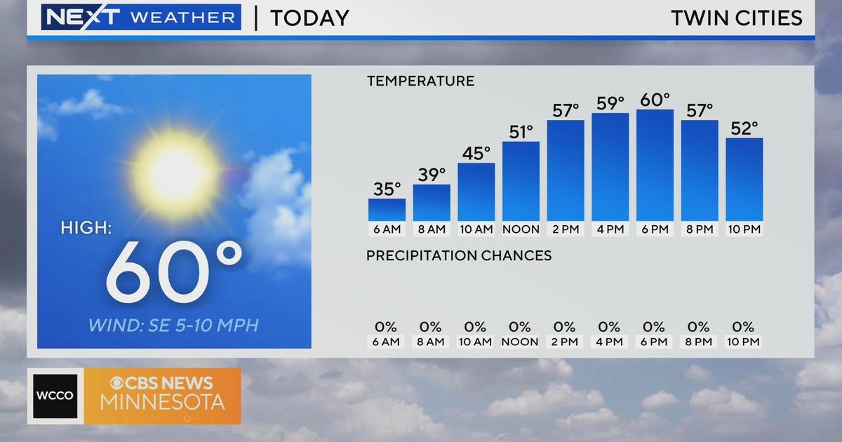
The Twin Cities metro has enjoyed eight-consecutive days of above-average temperatures, and things will continue to stay on the mild side for much of next week. The snow pack will also take a major hit -- thanks to the rain that's on its way for much of the state.
A system carrying light snow moves west to east across west-central Minnesota Thursday night, but it's just an appetizer for the system that will be bringing the potential big precipitation.
Friday will be mild again, and sunshine will help make it a great one to get outside and embrace winter. But come midnight, the big system rolls into southwestern Minnesota, triggering a Winter Storm Watch for a large swath of the state.
Light snow will be falling again on much of Minnesota by Saturday morning, but snow will turn to rain in southeastern Minnesota by the late afternoon.
West and northwest Minnesota will have the best chance at getting snow out of this storm, while the southeastern part of the state more likely to get rain.
The system will keep rolling through until mid-Sunday. The Twin Cities may only see a little over an inch of snow, while areas in southwest, north-central and northeastern Minnesota could see anywhere between 4 and 9 inches of snow -- with Duluth yet again on the high end of the accumulation scale.
More snow is also expected Monday, and high temperatures will dip below freezing for the first time in days on Tuesday.