Minnesota Weather: Road Conditions Improve Before A Re-Freeze Overnight
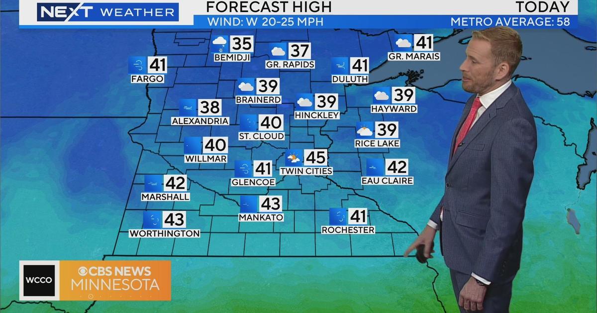
MINNEAPOLIS (WCCO) -- After a wintry mix affected most of the Twin Cities Saturday morning, the metro area can expect a more mild Sunday with fog, drizzle and scattered showers throughout the day.
WCCO meteorologist Mike Augustyniak says road conditions have improved since yesterday due to the above-freezing temperatures.
However, snow continues to fall in parts of western and northern Minnesota. According to the WCCO Weather Watcher network, some of the highest totals were in north-central Minnesota, including 7.0" in Inger, 6.0" in Nevis and 5.5" in Underwood as of 7 a.m.
A blizzard warning has also been issued for parts of north-western Minnesota.
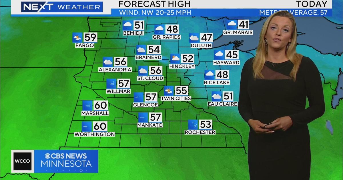
As for the Twin Cities, colder air will filter in Sunday night, resulting in precipitation changing to snow late tonight and Monday. Augustyniak also cautioned that the colder air, combined with moisture leftover from today's rain, could create icy travel on Monday morning where roads haven't been re-treated with chemicals.
In terms of snowfall, Augustyniak says the Twin Cities will see an average of 2-4 inches before ending late Monday night.