Minnesota Weather: Possible Hurricane-Force Winds Roll Through State Overnight
MINNEAPOLIS (WCCO) -- It will be a wild night and early morning of severe weather for much of Minnesota, with damaging winds in the form of a possible derecho being the main threat.
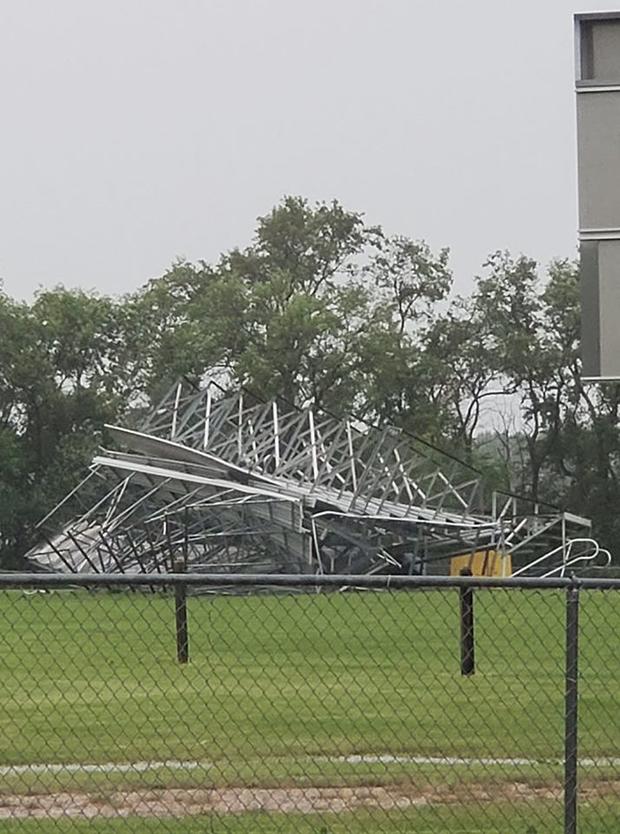
There have been dozens of reports of wind damage throughout northwestern Minnesota Friday evening, including in Argyle, where there are many downed trees, as well as damaged silos and outdoor bleachers.
Straight-line winds could reach hurricane-force speeds of 90 mile an hour in part of the state. Even though most alerts throughout the state are labeled as Severe Thunderstorm Warnings, they should be treated as tornado warnings.
The enormous storm system will begin pushing into the northern Twin Cities metro between midnight and 2 a.m., and will begin pushing into western Wisconsin by 3 a.m.
Dew points will remain tropical going into Saturday, with temperatures forecasted in the 90s – but the humidity will likely push heat indices into the triple digits.
There is also slight risk of severe weather for much of Minnesota Saturday afternoon. Temperatures will start to drop a bit starting Sunday, but there will be more chances for storms throughout the upcoming week.
Keep an eye on the weather at all times with WCCO's weather app or on our weather page.