Weather Timeline: Severe Thunderstorms In Western Wis., Possible In Southern Minn.
UPDATE (3:10 p.m.): A severe thunderstorm warning has been issued for several western Wisconsin counties.
Dunn, St. Croix and Barron counties are under the watch until 3:30 p.m.
WCCO Meteorologist Chris Shaffer said the storm was moving northeast at 40 mph, and that hail and strong winds were the main concerns.
In Minnesota, Wabasha County is under a severe thunderstorm warning until 4:15 p.m.
Dodge, Fillmore, Goodhue, Houston, Mower, Olmsted and Winona counties are under a severe thunderstorm watch until 10 p.m.
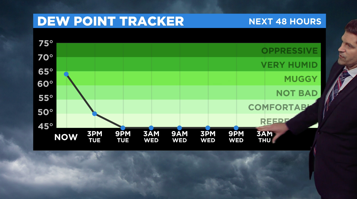
MINNEAPOLIS (WCCO) - After a stretch of hot and muggy days, the dew point will drop on Tuesday afternoon, bringing in more comfortable and dry air.
Showers and thunderstorms rolled through the metro area on Monday night, leaving behind a half an inch of rain.
Even though dew points on Tuesday will start up high, they will drop dramatically in the afternoon. According to WCCO meteorologist Riley O'Connor, the state will stay in the "comfy and refreshing zone" through Thursday.
Tuesday will also be windy, with gusts coming up from the southwest. Northwestern Minnesota is under a wind advisory, as gusts could reach up to 45 mph.
In eastern Minnesota, some light showers and sprinkles could pop up between 2 p.m. and 4 p.m. The rain will move towards western Wisconsin and could possibly develop into severe weather with a risk of larger hail.
Temperatures in the Twin Cities will reach 87 degrees on Tuesday, though the lows will drop to 53 degrees.
Clouds will move in on Wednesday night and there will be a chance for showers, leading into a soggy and rainy Thursday.