Minnesota Weather: Brief Tornado Touchdown Reported Near Brooten Friday Evening
MINNEAPOLIS (WCCO) -- After days of dry, steamy weather with temperatures in the 90s, thunderstorms are expected to wash over Minnesota on Friday, and some of them could be severe.
------
UPDATE (9 a.m. Saturday):The Twin Cities recorded a tenth of an inch of rain overnight, but areas to the north and west saw much more rainfall; Park Rapids recorded over 3 inches, while Ottertail recorded 2.8 inches.
A weak, short-lived tornado touched down in Stearns County around 6:30 p.m., but there was no widespread damage.
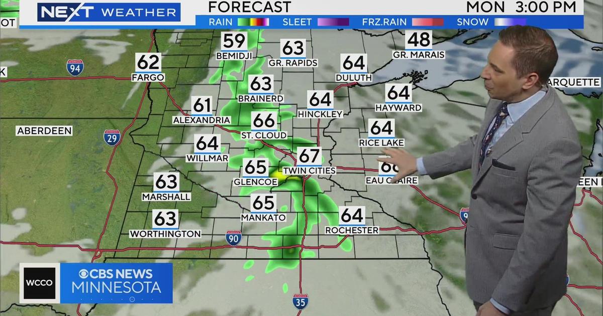
Saturday morning will start out cloudy with a crisp afternoon on the way. Temperatures in the Twin Cities will reach the low-70s.
UPDATE (8:30 p.m.): A number of counties remain under a severe thunderstorm watch going into Friday evening, after at least one NWS-reported tornado touchdown in the vicinity of Brooten.
WCCO meteorologist Lisa Meadows says that a few western counties were dropped from the severe thunderstorm watch, but a number of them remain in effect until 10 p.m.
Meadows said storms are starting to push into the Twin Cities metro area, but the severe storm threat is continuing to diminish and should continue to do so the later into the evening we go.
UPDATE (6:45 p.m.): All of western Minnesota is under a severe thunderstorm watch until 10 p.m. A severe thunderstorm warning was issued in Pope and Stearns counties, and the National Weather Service says there are reports of a brief tornado touchdown about 1.5 miles southeast of Brooten at about 6:30 p.m.
The main threats to watch for, according to Meteorologist Lisa Meadows, are ping-pong-sized hail and winds up to 70 mph. There is also the possibility for tornadoes in western Minnesota.
As the storms make their way further east, the storms will weaken, and the possibility of tornados will diminish to about 2%.
UPDATE (2:35 p.m.): Severe thunderstorm watches are in effect until 10 p.m. for a large swath of northwestern Minnesota.
It includes Becker, Beltrami, Cass, Clay, Clearwater, Crow Wing, Grant, Hubbard, Itasca, Kittson, Koochiching, Lake of the Woods, Mahnomen, Marshall, Norman, Otter Tail, Pennington and Polk counties. Red Lake, Wadena and Wilkin counties also have the watch in effect until 10 p.m.
UPDATE (2 p.m.): Severe thunderstorm warnings have been issued in Beltrami, Clearwater, Lake of the Woods, Marshall and Pennington counties until 3 p.m.
Through about 4 p.m., severe storms will be a factor in northwestern Minnesota, but increasingly west-central and southwest Minnesota.
"So, places like Marshall, Worthington and Granite Falls will likely be getting some of the heaviest thunderstorm activity by or around that point," meteorologist Mike Augustyniak said.
Approaching 6 p.m., storms are expected to merge into a line of storms, stretching from north-central Minnesota down to south-central Minnesota. Threats of damaging straight-line winds and hail could come along with the storms. However, brief spin-ups of tornadoes could be possible.
UPDATE (Noon): Rain and storms began moving into northwestern Minnesota around noontime Friday. Meanwhile, the National Weather Service is tracking storms in the Dakotas that are producing wind gusts strong enough to knock down tree limbs.
The office in Grand Forks, North Dakota, says that the storms are developing as they move toward the Minnesota border, adding that they threaten to produce quarter-size hail, damaging winds, and isolated tornadoes. Heavy rain could also lead so some localized flash flooding.
Augustyniak says this line of storms is expected to reach western Minnesota around 3 p.m., at which point the storms could become severe. Through the early evening, these storms will evolve into a line that cuts across central Minnesota, with heavy rain possibly masking any tornadoes that develop.
As the line moves east toward the Twin Cities through the late evening, the threat for tornadoes will diminish although damaging winds will still be possible.
MINNEAPOLIS (WCCO) -- After days of dry, steamy weather with temperatures in the 90s, thunderstorms are expected to wash over Minnesota on Friday, and some of them could be severe.
Meteorologist Mike Augustyniak say the storms will likely develop in western Minnesota in the afternoon and push eastward across the state, hitting the Twin Cities in the late evening hours.
WATCH: Get Storm Updates Every Hour On CBSN Minnesota
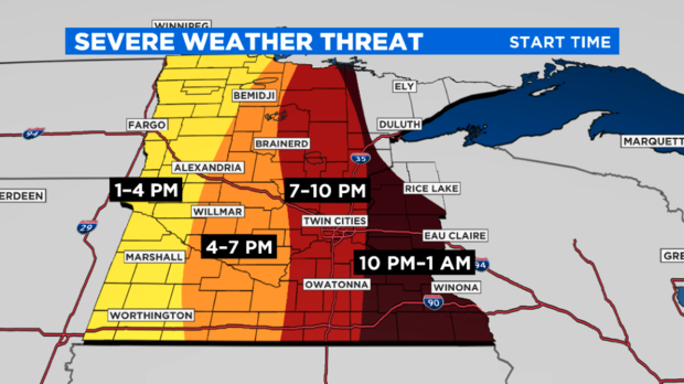
The National Weather Service has listed much of central Minnesota, including the metro, under a slight risk of severe weather. Threats include damaging winds, large hail, isolated tornadoes and heavy rain. Forecasters say the storms will likely weaken as they approach western Wisconsin.
RELATED: Download the WCCO Weather App
Following the storms will come cooler air and a significant drop in humidity. Saturday's temperatures are only expected to reach the low 70s. Temperatures will remain mild on Sunday, when there is another chance for rain.
More rainfall and storms are expected early next week. Over the next five days, some communities could see more than 2 inches of rain, particularly in drought-stricken north-central and northwestern Minnesota.
According to the latest update from the U.S. Drought Monitor, those areas are experiencing extreme and exceptional drought conditions. Meanwhile, nearly 90% of the state is under severe drought conditions.
Wildfires burning in the Boundary Waters Canoe Area Wilderness and Superior National Forest may also be dampened by the coming rain.