Minnesota Weather: Developing System Could Bring 1st Snowfall Of The Season
UPDATE: Read the updated story here.
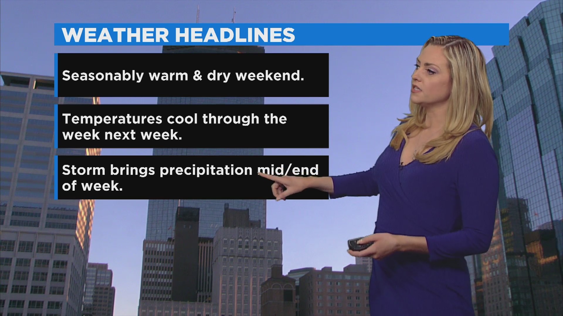
MINNEAPOLIS (WCCO) -- While this weekend's weather has been perfect for the deer opener, yard work and other outdoor activities, a storm system is developing that could bring snow to Minnesota by the end of the coming workweek.
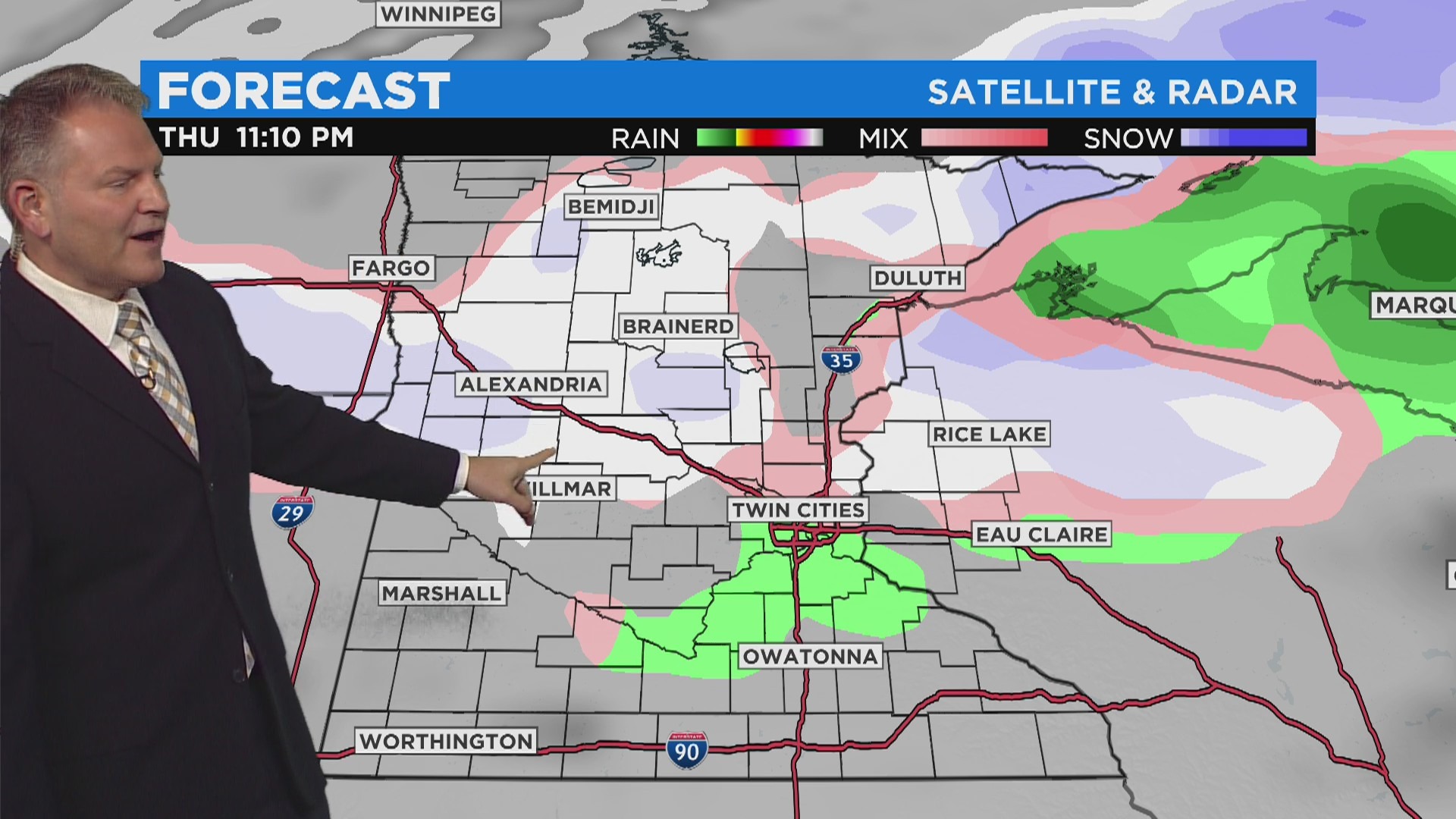
WCCO meteorologists say the latest model data shows the system arriving Wednesday night going into Thursday.
"For now we're mainly looking at rain, but as the system evolves and gets closer, it is possible we could wrap some cold air back on the back side of that system, which might drop a little bit of light snow," said Meteorologist Lisa Meadows.
She added that one forecast model shows it'll come in as all rain, and another model says the system will start out with rain and transition into snow.
The details will become clearer in the coming days, Meadows said.
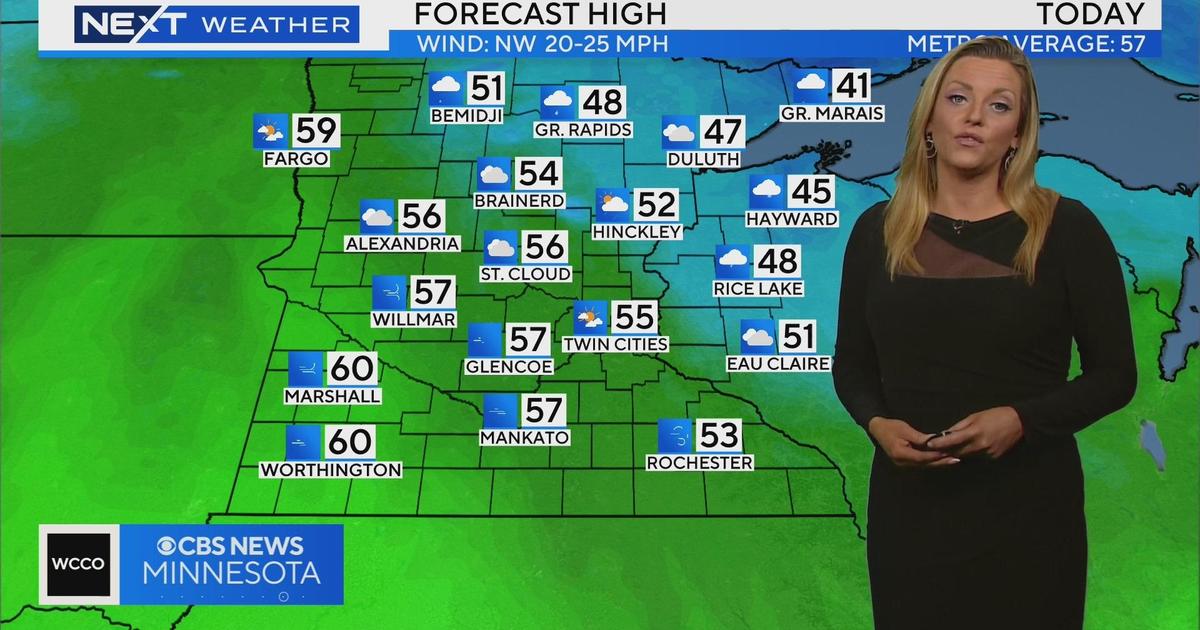
But before it's time to think about snow (and sunsets before 5 p.m.), Minnesotans can enjoy a warm weekend. Saturday, which marked the firearms deer opener, was sunny with highs in the low 60s. It's well above average for this time of year, which usually sees temperatures in the mid-40s.
The warmth will continue Sunday, but there will be more cloud cover. Highs will likely be about 65 degrees in the metro.
Temperatures will cool a few degrees as the workweek kicks off Monday.
The first average snowfall date in the Twin Cities is Nov. 2.