MN WEATHER: Another Multi-Day Storm Looks To Hit State This Weekend
Posted March 1, read the updated story here.
MINNEAPOLIS (WCCO) -- Another multi-day winter storm is expected to hit Minnesota this weekend.
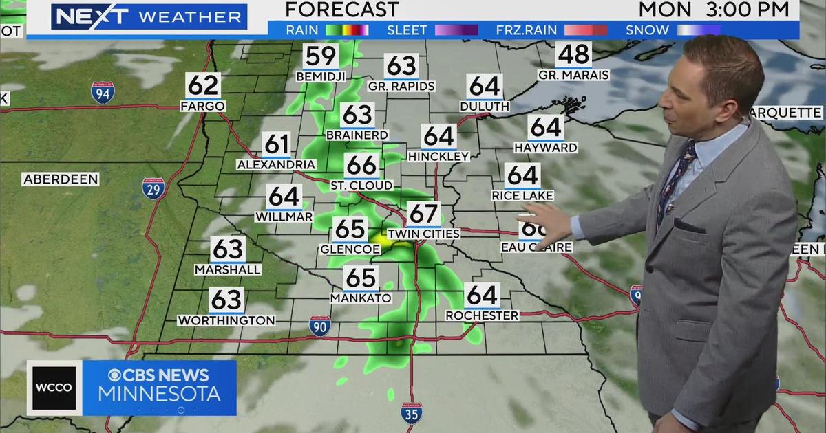
The WCCO Weather Team reports that the system looks to arrive Friday night and last through Sunday morning, affecting much of the state.
However, it's too soon to tell what the system will bring. Because of the warm air ahead of the system, some areas could see rain, a wintry mix or snow, depending on local temperatures through the course of the weekend.
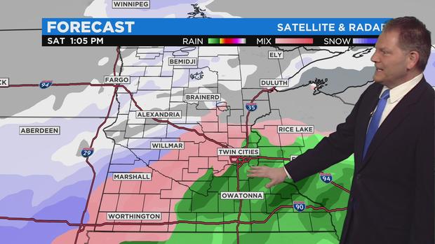
If only snow falls in a given area, accumulations up to a foot could be possible. Such an event would be reminiscent of the two-day system that hit central Minnesota earlier this month. Yet, it's possible that parts of southern Minnesota could get a lot of rain.
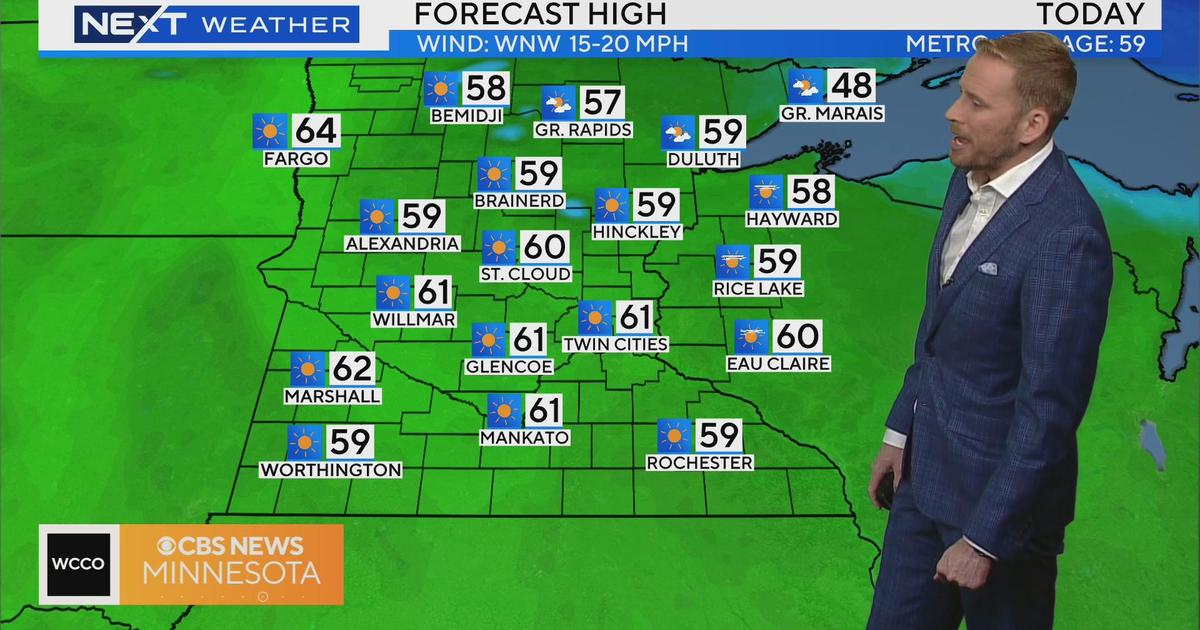
Meanwhile, Tuesday is expected to be a slightly cooler day, but mostly dry. Temperatures are expected to hit 36 degrees.
Ahead of the weekend storm, another Alberta clipper system is tracking to hit northern Minnesota late Tuesday night into Wednesday, leaving less than an inch of snow in most spots. The system could also clip the Twin Cities metro early Wednesday morning. South of Interstate 94, isolated areas could see freezing drizzle.
While temperatures look to gradually cool throughout the week, they'll remain generally mild, with highs reaching the low 30s most days. Thursday will be the coolest day of the week, with a high of 25 in the metro.
For the latest on the coming storm, check back with WCCO-TV, WCCO.com or CBS News Minnesota.