Minnesota Weather: Mild Weekend With Chance For Snow In Northern MN
MINNEAPOLIS (WCCO) -- A mild weekend will lead into a warm, spring-like week, but not before two quick rounds of snowfall in northern Minnesota.
Friday was likely the last night of sub-zero temperatures in the metro area, according to Meteorologist Mike Augustyniak. On average, the Twin Cities area sees 22 nights below zero during the winter, but this year we've seen 26. That's the most recorded since 2018.
But after the bitter cold, Saturday's high temp will reach 25 degrees in the metro area. Areas to the southwest could get to 34 degrees.
Then a quick-hitting system will bring light snow to northwestern Minnesota overnight. It'll impact areas north of Interstate 94; the Twin Cities could see a dusting of snow, while the Duluth area could see 1-2 inches of accumulation.
The snow will melt through the day Sunday in the metro and high temps will reach around 42 degrees.
However, late Sunday night into Monday morning, another round of snow will bring some accumulation north of I-94. It could bring a few hours of sleet during Monday morning's commute.
But, it is spring, and a meltdown is coming.
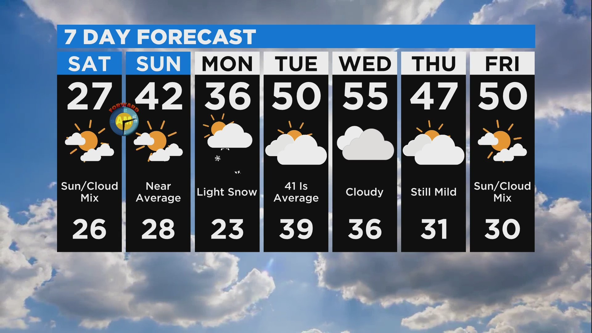
Temperatures look to be above average for most of next week, with the mercury even hitting 50 degrees. With the warmth will come significant melting, and it's possible the Twin Cities will see its snow pack slip away.