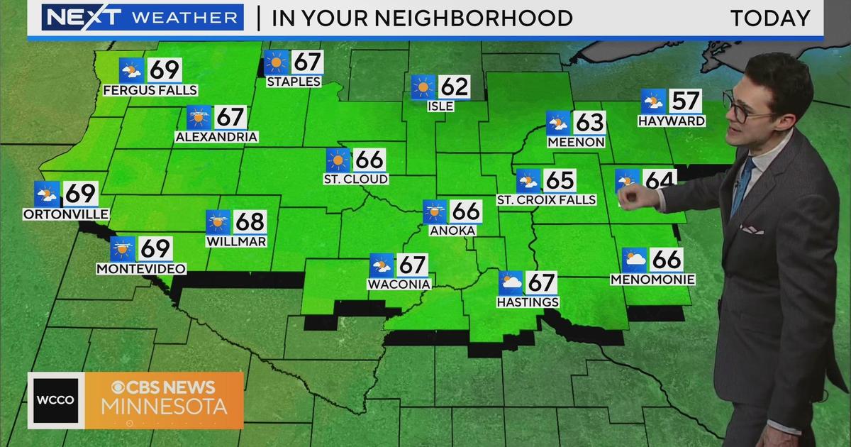
Weather Blog: Our Warmest Day
MINNEAPOLIS (WCCO) -- Tuesday will be the warmest day of 2011.
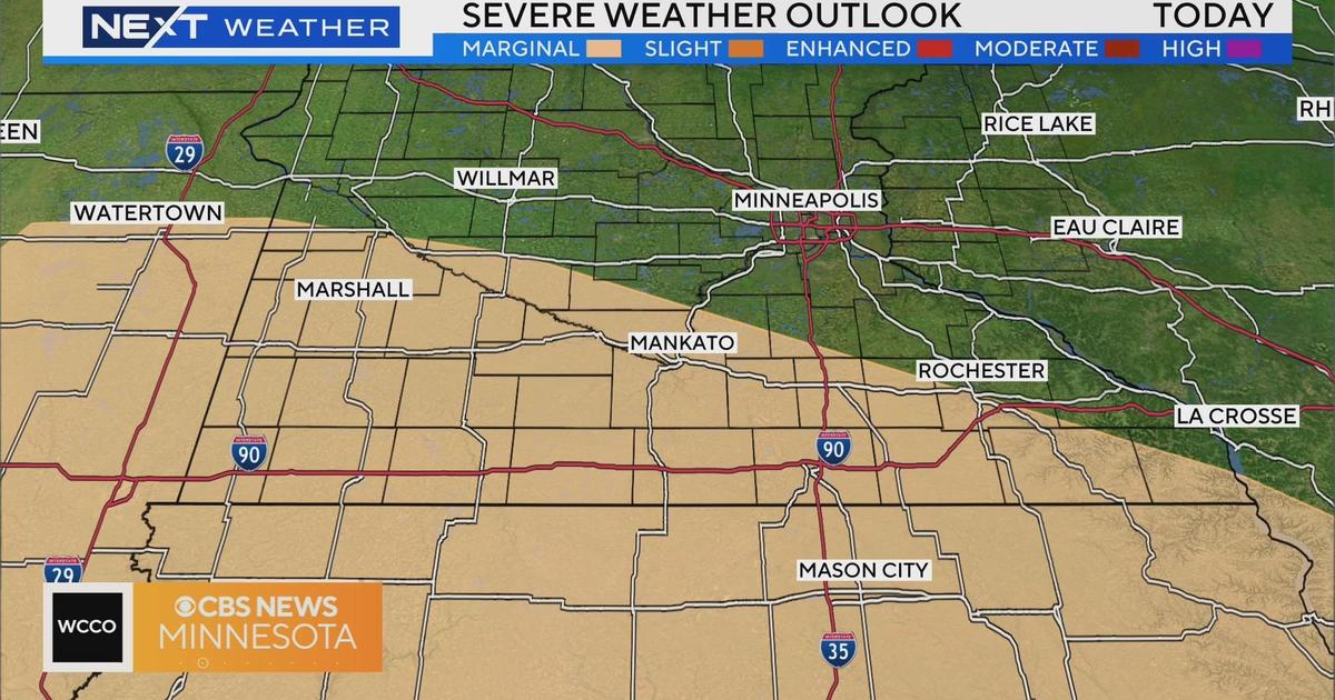
We have not warmed into the 80s in nearly 7 months, but that is about the change. A warm front will surge to the north bringing warm air near the surface and high up in the atmosphere, which will keep the severe weather at bay.
We could have a few showers or isolated storms pop along the front, but the headline will be the heat along the somewhat humid air.
The best chances of rain the next few days will be during the overnight hours.
Then a cold front will swing through and stay with us until Thursday. That will knock our temps back to the low 70s, and we tumble back to the 60s as the weekend draws near.