Weather Blog: It's Going To Get Warm...Finally
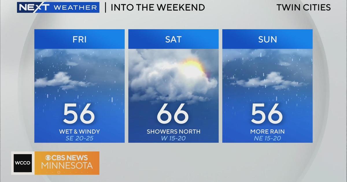
An area of light to moderate rainfall will continue to move north out of Iowa and bring a soggy Sunday evening to south-central and southeastern Minnesota. The chance for showers Sunday evening does extend to the Twin Cities, with the best chance of rain across the southeast Metro.
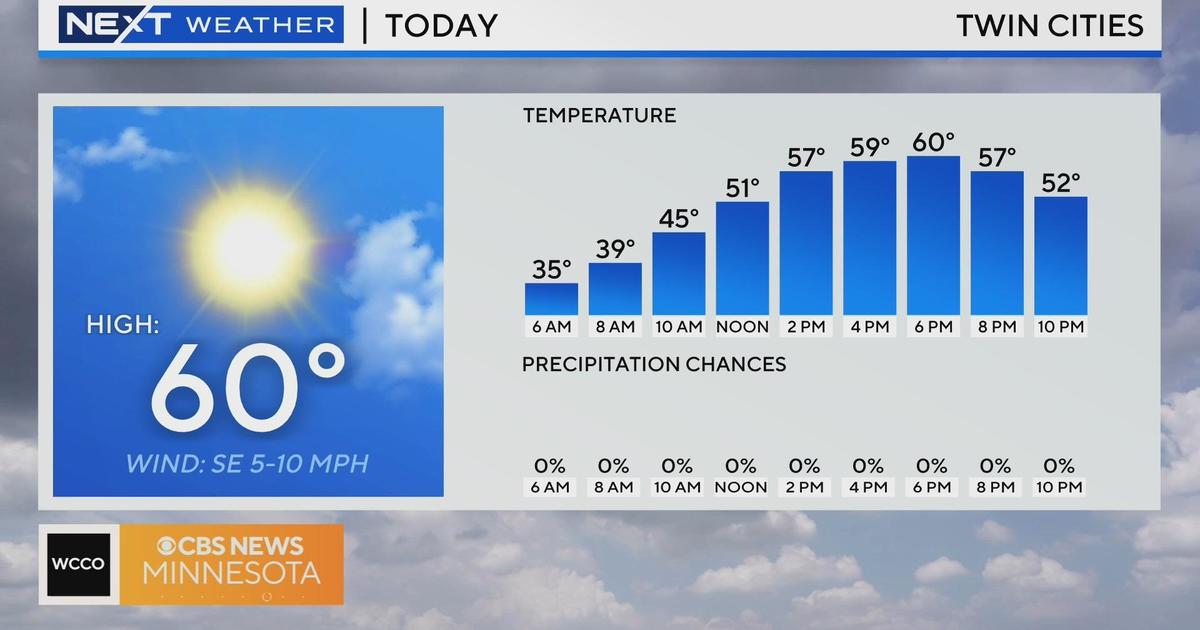
Shower activity will likely diminish by early Monday morning, but by lunch time sunshine should punch through the clouds. The warm up will continue as highs near 70 degrees on Monday.
Near-80 degree highs are on tap for Tuesday, yet the warmth will build in ahead of a strong area of low pressure set to bring thunderstorms to the metro late-day Tuesday.
This system looks to slow and strengthen over the region, keeping showers and storms in the forecast for Tuesday night and much of Wednesday. Strong to severe thunderstorms are possible.