Weather Blog: 1° Of Separation
Well, that was unpleasant.
This morning's mix of wintery precipitation prompted a round of "what is this stuff falling from the sky?" on Twitter and Facebook ... and it's a good question. We all know what rain and snow look like, but it can be harder to identify the 3 different types of precipitation that aren't quite rain and aren't quite snow. First, some background.
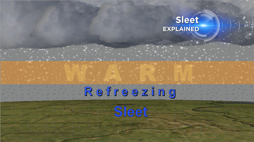
Sleet falls from the sky as solid ice pellets that look like pebbles or large grains of sand. It accumulates more like snow, in that it tends to bounce off of things like tree limbs and power lines. In order for sleet to form, there must be a layer of warm air overhead, sandwiched between 2 deep layers of sub-freezing air. Snowflakes falling into the warm layer will either partially or completely melt before refreezing into little ice balls. Sleet is different from hail, which only form in the presence of a thunderstorm.
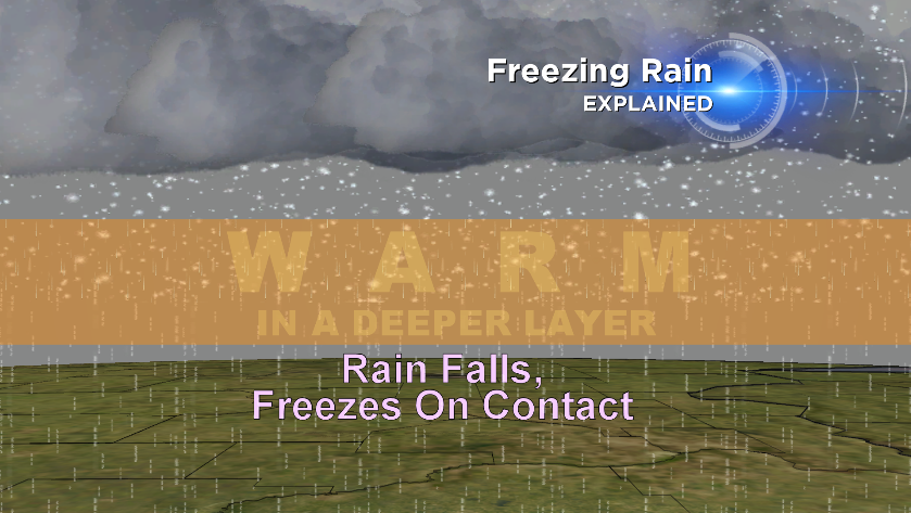
As its name implies, freezing rain falls from the sky as liquid and then freezes into a glaze of ice on contact with the ground or other objects. Freezing rain can form in one of two ways; when snowflakes fall through a layer of warm air, melt completely, and then encounter a shallow layer of sub-freezing air right near the ground, or when rain falls from a cloud and meets a shallow ground-based layer of sub-freezing air. In both cases, the ice that forms can stick to tree limbs and power lines, creating the potential for power outages.
http://twitter.com/dbrauer/statuses/445559323834322944
So, while some freezing rain fell early this morning in the Twin Cities, most of what pelted us in the face was sleet. Some of you asked if a third type of precipitation -- graupel -- was falling today. The answer is no, and here's why. Graupel looks a lot like sleet but has a softer more "spongy" consistency, owing to how it forms. Whereas sleet exists as a water droplet at some point during its trip down from the clouds, graupel partially retains its identity as a snowflake for most of the trip. These snowflakes encounter a layer of water (or water vapor) in a sub-freezing environment; so-called "supercooled" water droplets. This water deposits itself as an ice glaze on the outside of the snowflake, effective encapsulating it. That's graupel.
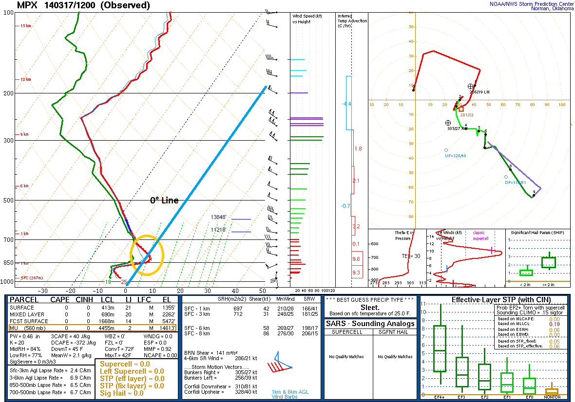
Twice daily, at 7am CDT and 7pm CDT, the National Weather Service in Chanhassen launches a weather balloon to create a "sounding" of the atmosphere above. From that sounding we can determine how temperatures change overhead, and where any warm layers may be. This morning's 7am sounding showed a layer of above-freezing air overhead (circled in red). The warm layer began about 4,300 feet overhead and was about 2,000 feet deep; deep enough to melt falling snowflakes, and far enough off the ground to allow them to re-freeze. Hence, sleet.