Marginal Chance For Severe Storms Thursday
MINNEAPOLIS (WCCO) -- Crisp, fall-like conditions opened the work week, but the calendar says it's still summer.
Thursday could bring with it some potentially severe storms to the southern portion of Minnesota.
WCCO meteorologist Matt Brickman said storms were moving through the southwest area of the state around noon, including through Willmar, Worthington and Windom. The line was moving eastward at a not particularly swift rate.
A flash flood warning had been issued for Nobles and Jackson Counties until 7 p.m.
Brickman said the rain could start closer to the Twin Cities later in the afternoon and into the evening, with what is likely to be the biggest dousing arriving around 6 or 7 p.m.
According to Brickman, the biggest threat from the storms is likely from potentially damaging winds, with tornados and hail far less likely.
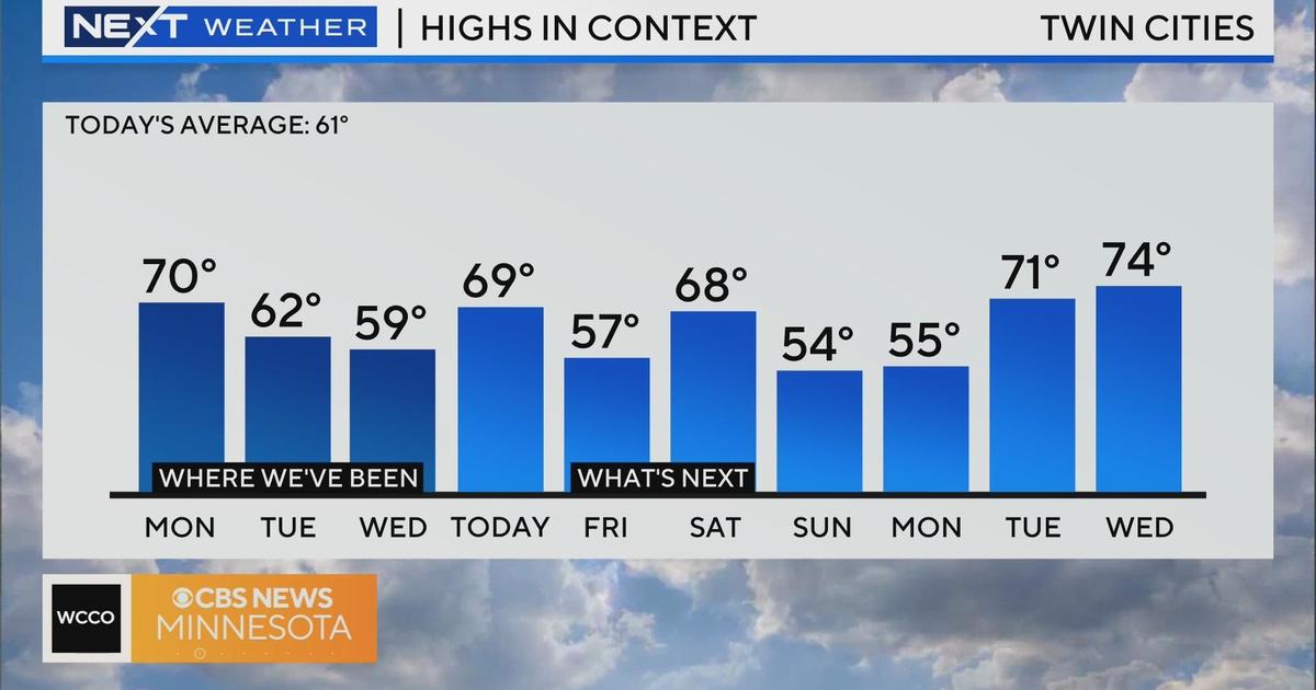
The rounds of rain are expected to continue into Friday, but the weekend is shaping up to be nice and dry. Temperatures early next week should be in the upper 70s.