Lauren's Science Corner: Minnesota May Tornadoes
On Saturday, May 16, a mini-tornado outbreak occurred in west-central Minnesota with a preliminary total of 15 tornado touchdowns.
A survey conducted by the National Weather Service in Chanhassen rated two of the tornadoes, which caused property damage, at EF-0 strength.
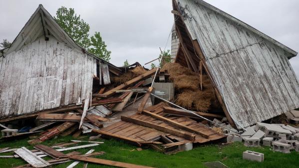
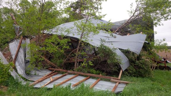
In Darwin, southeast of Litchfield, an EF-0 tornado with winds of 80 to 85 mph traveled 5.5 miles and caused considerable damage to a farmstead. All outbuildings on the property were destroyed and several irrigators tossed into a field. Residents of the farmstead estimate the damage at $80,000.
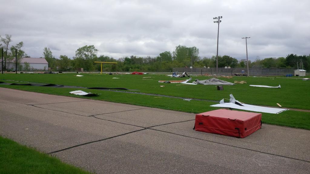
A second EF-0 tornado touched down in Kimball. It traveled 1 mile and resulted in damage to Kimball High School's football field.
Based on averages from 1991 to 2010, 45 tornadoes touch down each year in Minnesota.
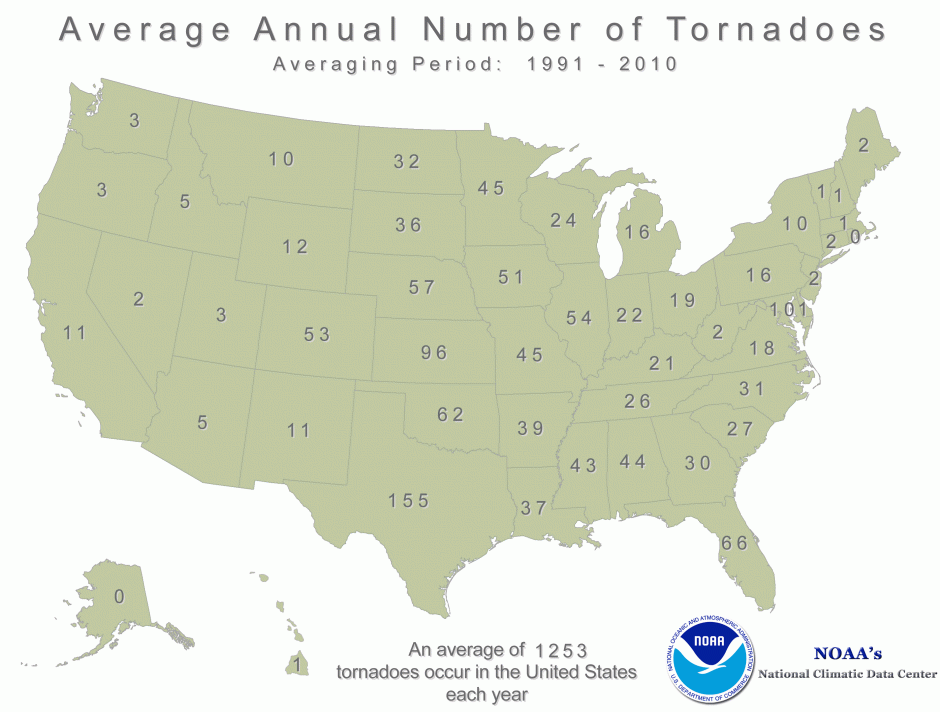
You could say that May opens the door to tornado season in Minnesota, yet the month only experiences five tornadoes on average annually. Thus, for 15 tornadoes to impact the state in one day is on the rarer side.
Last May, three Minnesota tornadoes were reported for the entire month, two in May 2013, 12 in May 2012 and 16 in May of 2011.
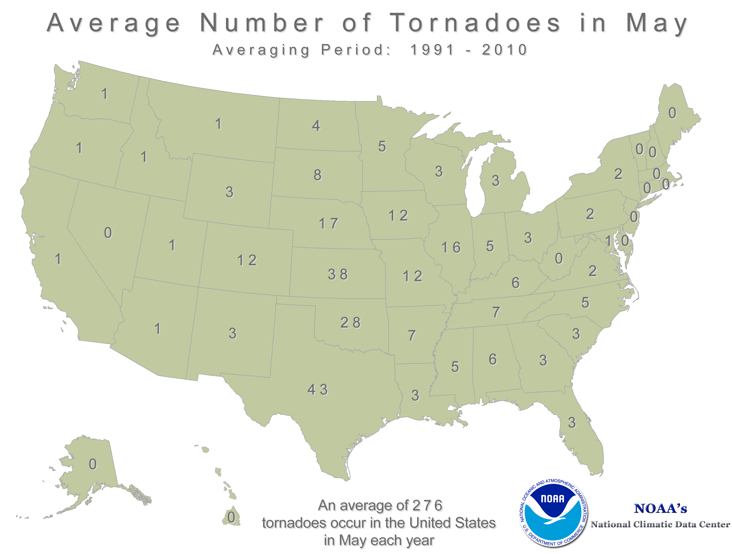
In 2010, no tornadoes occurred in the month of May however, Minnesota went on to rank No. 1 in the nation for annual tornado tally with a whopping 145 tornadoes reported!
101 of these twisters occurred in June, Minnesota's busiest month, when average tornado activity makes a marked jump to 18.

July stands as the second most active month for Minnesota tornadoes with 12 on average. The early summer significant activity uptick is due in large part to the northward migration of the jet stream.
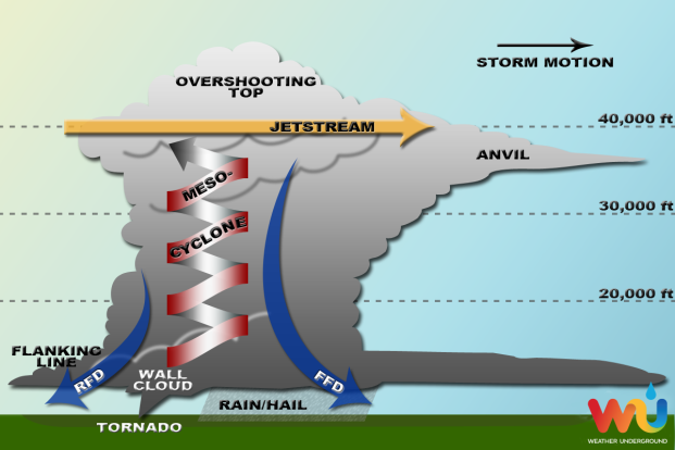
When overhead, the jet stream, a river of very fast winds at about 35,000 feet high in the atmosphere, provides and energy and vertical speed to the updraft of the parent supercell thunderstorm.
As prime tornado time in Minnesota is on approach, be sure to stay weather aware!
Remember, present day weather technology allows meteorologists to predict a potential severe weather event 3 to 5+ days out.
Check out the Storm Prediction Center's daily Convective Outlooks, which we at WCCO reference during the forecast and can be found on the SPC's website.
The specificity of the forecast; localized geographic area, timing and level of threat, increases as the event day nears, so always keep informed from days out through when the storms begin to form.