Storms Expected To Soak Southern Minnesota, Flooding Possible
MINNEAPOLIS (WCCO) – Summer is going out with a bang in Minnesota as another night of severe storms and heavy rain is in store for the southern part of the state.
The National Weather Service says a flash flood watch is in effect through Thursday for southeastern Minnesota, western Wisconsin and northern Iowa.
There's both potential for flash flooding and river flooding. The threat is increased due to the wet summer and the already-swollen rivers in the extreme southern part of the state.
Minnesota communities south of Interstate 94 will likely see about 2 to 5 inches of rain through Thursday, the National Weather Service says. Some local areas could even see rain totals upwards of 7 inches.
The Twin Cities metro is expected to see 1 to 2 inches of rain.
There's also a slight risk of severe weather overnight Wednesday for much of southern Minnesota, with the possibility of scattered and intense thunderstorms.
The forecasted heavy rain and sever weather comes after a night of storms that dumped hail and drenched communities in southern Minnesota.
WCCO Weather Watchers in Waseca and Owatonna reported getting about 2 inches of rain overnight Tuesday.
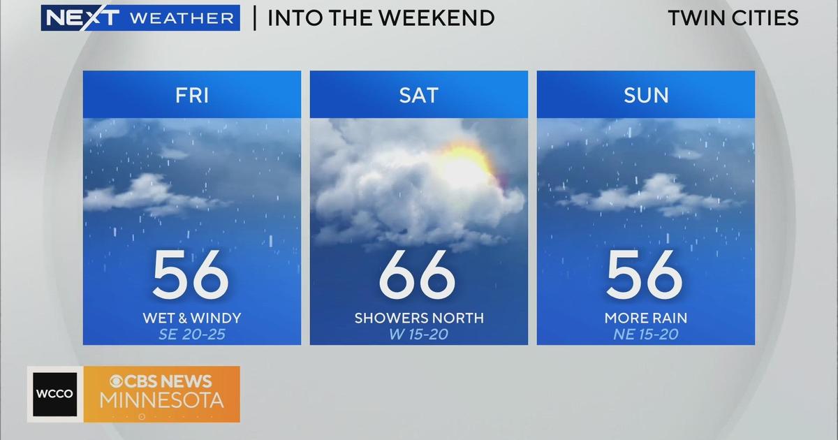
While the rainclouds look to move out of the state on Thursday, a new round of storms looks to swing through late Friday.
Saturday is also expected to bring rain.
RELATED: Download The WCCO Weather App