Minnesota Weather: Wave Of Severe Storms, Tornado Warnings
MINNEAPOLIS (WCCO) – Tornado and severe thunderstorm warnings have developed across the state. Here is the latest.
10:31 p.m.
There is a flash flood warning for Dodge and Olmsted counties into early Saturday morning.
9:12 p.m.
Flash flood warnings are popping up throughout the state:
6:41 p.m.
All Minnesota tornado warnings have expired.
6:04 p.m.
A reportedly brief tornado is said to have touched down north of Henderson, Minnesota. A tornado warning has been issued for Scott and Sibley counties until 6:15 p.m. and until 6:30 p.m. in Le Sueur County.
5:59 p.m.
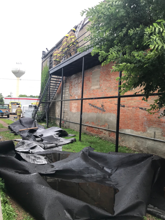
There are reports of a brief tornado touchdown and ping-pong ball size hail in Arlington. Damage and flooding has also been reported in Arlington.

5:39 p.m.
4:48 p.m.
8:43 a.m.
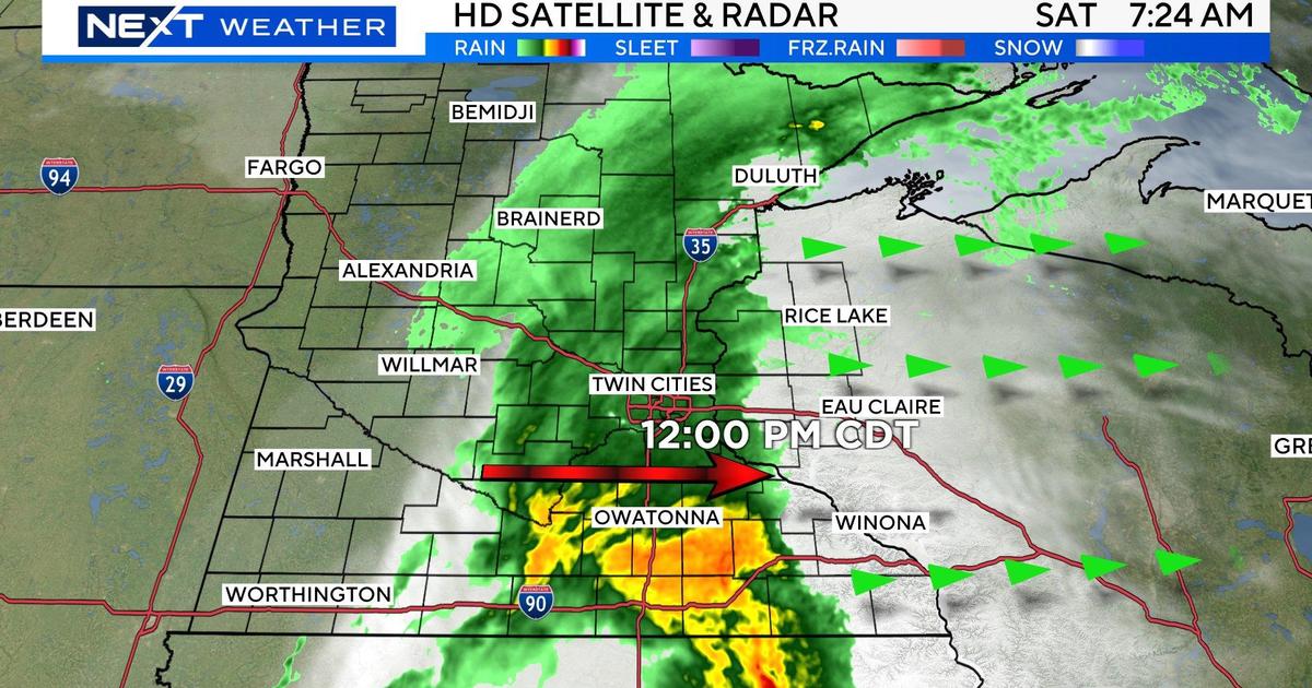
Scattered showers and thunderstorms look to wash over Minnesota on Friday, arriving in the Twin Cities in the afternoon.
Meteorologist Mike Augustyniak says a front will move east across the state, starting in western Minnesota around noontime and reaching the Twin Cities in the afternoon.
The National Weather Service says most of southern Minnesota, including the southern Twin Cities metro, is under a marginal risk of severe weather. Threats are limited to heavy rain and strong wind gusts.
Severe storms could develop mainly this afternoon and across southern MN this afternoon and exit to the southeast tonight. #mnwx #wiwx pic.twitter.com/D111t2WusP
— NWS Twin Cities (@NWSTwinCities) July 5, 2019
Looking at the rest of the weekend, there's a chance both Saturday and Sunday for scattered showers and storms across southern and central Minnesota.
However, a high pressure front will sweep down from Canada, cutting down on the humidity that's settled over the state for the last several days.