MN Weather: Sloppy System Threatens Ice Storm In Western Wis., Possible Tornadoes
Stay Informed: WCCO Weather App | Live Radars | More
More Certain
-- Location: Fergus Falls to the North Shore and points south
-- Worst travel: Before sunrise and after sunset Saturday
-- Precipitation: A bit of everything -- rain, snow, sleet, and freezing rain
-- Icing: Northwestern Wisconsin could see significant icing early Saturday
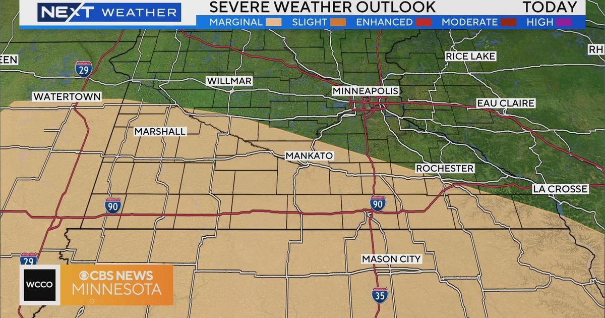
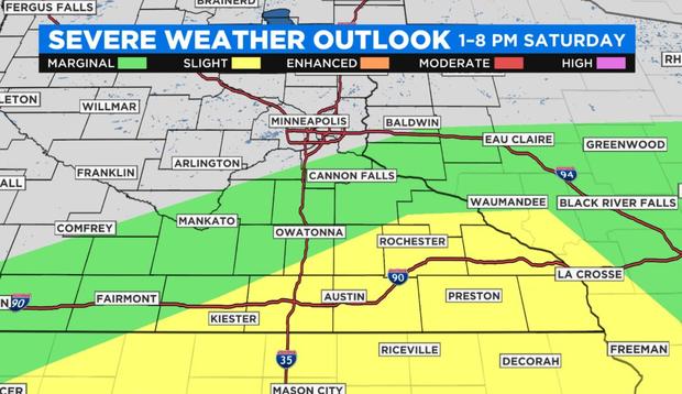
-- Severe weather: Strong storms are possible in southern Minnesota, perhaps with straight-line winds and even tornadoes
Less Certain
-- Snow: Amounts depend on temperatures, changeover times
-- Tornadoes: If tornadoes do touch down in Minnesota on Saturday, they'd be the earliest on record
MINNEAPOLIS (WCCO) -- A sloppy spring storm system is blowing into Minnesota and western Wisconsin, threatening to bring a smorgasbord of weather to the region, from possible severe storms -- even tornadoes -- in southern Minnesota to an ice storm in western Wisconsin.
The National Weather Service has issued an ice storm warning Saturday for most of northern Wisconsin, including Polk, Barron and Rusk counties, which line the border with Minnesota. The warning will be in effect from midnight to noon Saturday, when ice could coat road surfaces, tree branches and powerline infrastructure.
Forecasters say the travel in the area will be strongly discouraged and they urge those who must travel to bring a flashlight, food and water in case of an emergency. Additionally, the ice could bring down power lines, causing outages. Residents in northern Wisconsin are advised to prepare before the storm hits.
In Minnesota, much of the state is under a winter weather advisory, and counties surrounding the Twin Ports area are under a winter storm warning. The advisory area in Minnesota stretches from the southwestern corner of the state through central Minnesota and along the North Shore.
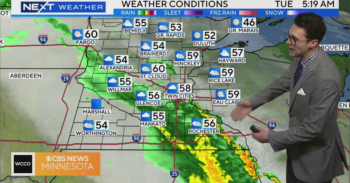
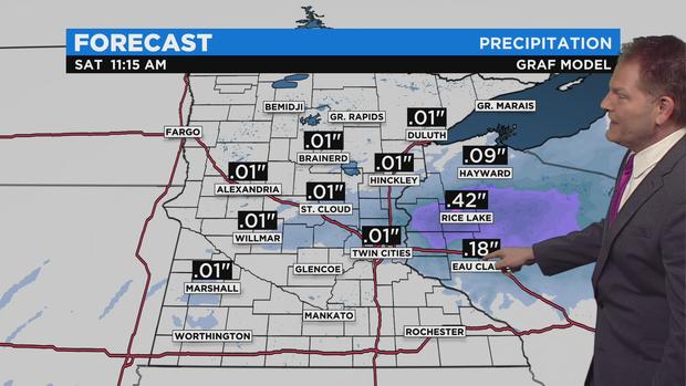
WCCO-TV's team of meteorologists says that the storm system will enter the region late Friday, bringing light rain to the Twin Cities. After midnight, a surge of warm air will rise up from the Great Plains and with it will come more rain, which will fall across Minnesota and northern Wisconsin, turning to ice when it hits cold surfaces. While the daytime warmth will likely melt the ice in the Twin Cities, the icing in northern Wisconsin is expected to be thicker and more resilient, particularly around the Rice Lake area.
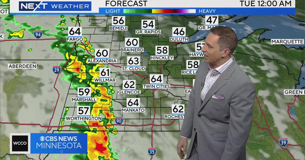
Waves of rain are expected through the day Saturday, and severe storms could develop in southern Minnesota and along the bluffs of western Wisconsin. Daytime highs Saturday will be in the 40s in the Twin Cities and perhaps in the 50s in southeastern Minnesota. According to forecasters, the main severe weather threat will be powerful straight-line winds. However, isolated tornadoes are also possible. Should twisters touch down in Minnesota, they'd be the earliest tornadoes on record, beating the last record set in 2017 by a day.
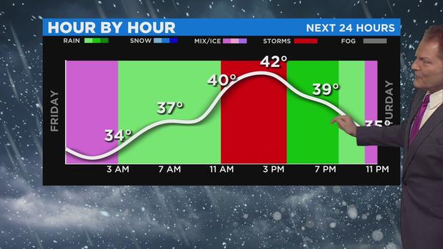
Saturday evening will bring another chance for icing in Minnesota as temperatures drop and the rain transitions into a wintry mix. Come Sunday morning, cold air will blow into the state, bringing widespread snow. Accumulations are expected to be light in the Twin Cities, but areas of west-central Minnesota could see around 5 inches of snow stack up. The snow band will likely cut across central Minnesota to the Duluth area, where up to 10 inches of snow could accumulate.
Following the storm, the workweek looks to bring sunshine and temperatures slightly below average. After Tuesday, temperatures will gradually cool until the weekend, when a blast of arctic cold is expected to hit Minnesota, bringing a stretch of winter-like weather that'll reach well into next week.