MN Weather: Bursts Of Snow, High Winds May Hamper Visibility Thursday
MINNEAPOLIS (WCCO) -- The winds were strong Wednesday, but they'll be even stronger Thursday.
The WCCO Weather Teams says a high wind advisory will be in effect Thursday for the lower two-thirds of Minnesota, with gusts of up to 40 mph possible at times. In western Minnesota, a high wind warning is in effect, and wind gusts could reach 55 mph.
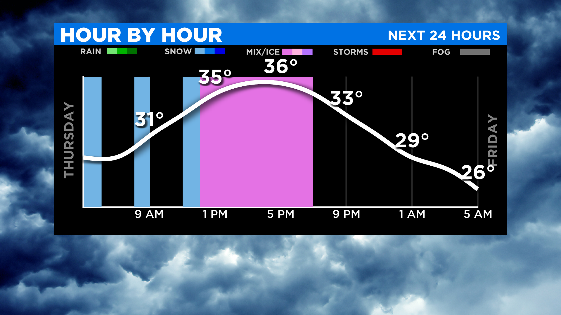
The high temperature in the Twin Cities will only reach 38 degrees Thursday, which is nearly 20 degrees below average. It will feel like the 20s all day because of that strong wind.
Minnesota will get a spattering of snow from the morning through late afternoon, including the metro. The occasional bursts of snow, combined with the high winds, will likely cause visibility issues at times. In far northern and northwestern Minnesota, 1-3 inches could accumulate. Don't expect much to stick around in the Twin Cities, though.
Minnesota will get to dry out Friday and Saturday, but the winds will still be prominent. High temps will be trapped in the 40s from Saturday through early next week.
Easter Sunday may feature some more of the rain-snow mix, and more rain is possible Tuesday and Wednesday of next week.
But cheer up, folks -- by the middle of next week, we could be back into the 50s.