Next Weather: Potentially Severe Storms In Store For Friday & Saturday
MINNEAPOLIS (WCCO) -- The chance for severe thunderstorms Friday night in Minnesota has shifted further to the southwest, and there's a chance for more widespread thunderstorms on Saturday.
The latest update from the National Weather Service's Storm Prediction Center shows that the southwester corner of the state, an area covering the cities of Worthington, Marshall and Montevideo, is under a "slight" risk of severe weather Friday night.
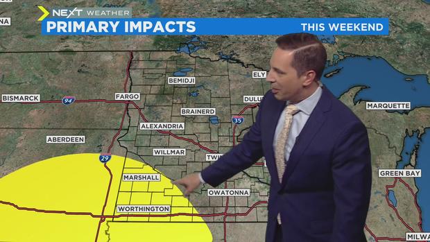
Slight risk is category No. 2 on the center's five-point scale, which goes from "marginal" to "high" risk.
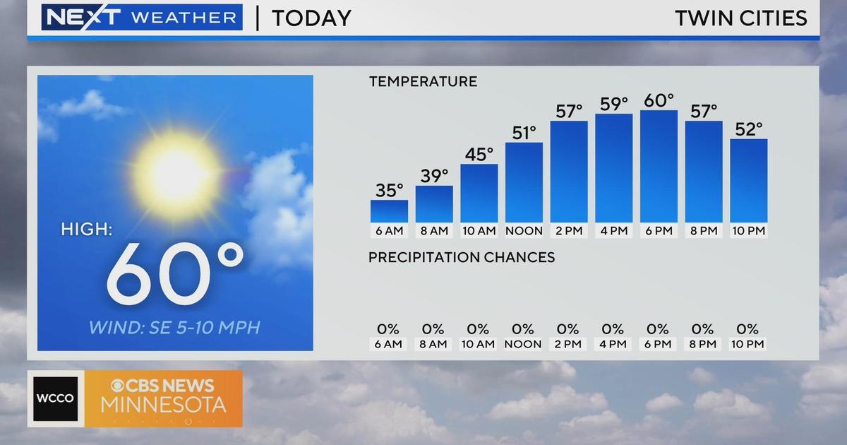
WCCO-TV meteorologists says that showers are expected to arrive early Friday but the chance for storms will come and into early Saturday morning. The main severe weather threat will be large hail.
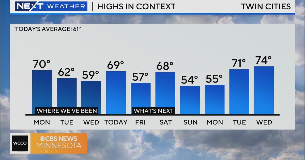
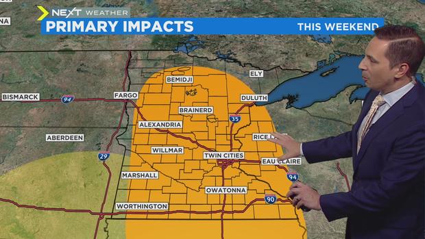
There's another severe weather chance Saturday, when daytime temperatures are expected to punch up into the 70s. The Storm Prediction Center has most of Minnesota under a slight severe weather risk, although it's still too early to say when and where the storms will hit.
Things look to dry out and cool down on Sunday, and temperatures will stay below average for much of the week.
However, the warmer weekend temperatures could lead to flooding in northern Minnesota.